SIRTA-ReOBS
SIRTA-ReOBS is a project whose goal is to synthetize, analyze, homogeneize, all SIRTA observations
hourly averaged in a single
NetCDF file.
It has been developped in order to study regional climate variability, for the particular
case of Paris area.
Actually, when interested in the regional climate scales that involve both the influence
of large-scale atmospheric circulation and local processes, it is necessary to use a dataset
suitable for these scales. But the exercise is complex because it involves all the system
parameters and all spatial and temporal scales. Also the small magnitude of the signals that
we are looking for, and connections between processes at local scales and anomalies at climate
scale, add to this complexity. It is therefore necessary to use a dataset dedicated to these
climate issues: multi-year, with good time resolution (hourly), multi-parameters without
calibration problem.
To make its data easily usable, the SIRTA [Haeffelin et al., 2005] provides an important
work on their homogenization, quality control, averaging... The goal of SIRTA-ReOBS project
is to write in a single netcdf file all variables hourly averaged from 2003 to now, their
description, quality control indices, their spatial and temporal variability.
- The oldest observations date back to 2003 and therefore have a strong statistical value in addition to the multi-annual coverage
- The time resolution also allows to address the daily cycle scale
- Multi-parameter approach allows rising to the level of processes
- The coupling of in situ, passive, and active remote sensing measurement, provides the most possible resolved atmospheric column at all time scales mentioned above
SIRTA-ReOBS scientific manager: Marjolaine Chiriaco, LATMOS/UVSQ
Acknowledgements:
SIRTA-ReOBS has been supported and funded by the Ecole Polytechnique, EUCLIPSE European project,
IPSL, LABEX IPSL.
References
SIRTA-ReOBS poster
Publications:
Chiriaco M., Dupont J.-C., Bastin S., Badosa J., López J., Haeffelin M., Chepfer H.,
Guzman R., 2018: ReOBS: a new approach to synthesize long-term multi-variable dataset and
application to the SIRTA supersite. Earth System Science Data, Copernicus Publications,
10 (2), pp.919 - 940.
Chiriaco M., S. Bastin, P. Yiou, M. Haeffelin, J.-C. Dupont, L. Klenov, M. Stéfanon, 2014:
European heat-wave in July 2006 : observations and modelling showing how local processes
amplify conducive large-scale conditions. Geophys. Res. Let., 41 issue 15, 5644 – 5652.
Cheruy F., J. C. Dupont, A. Campoy, A. Ducharne, F. Hourdin, M. Haeffelin, M. Chiriaco,
2013: Combined influence of atmospheric physics and soil hydrology on the realism of the
LMDz model compared to SIRTA measurements. Clim. Dyn., DOI 10.1007/s00382-012-1469-y.
Haeffelin, M., L. Barthès, O. Bock, C. Boitel, S. Bony, D. Bouniol, H. Chepfer, M. Chiriaco,
J. Cuesta, J. Delanoë, P. Drobinski, J-L. Dufresne, C. Flamant, M. Grall, A. Hodzic, F. Hourdin,
F. Lapouge, Y. Lemaître, A. Mathieu, Y. Morille, C. Naud, V. Noël, B. O'Hirok, J. Pelon,
C. Pietras, A. Protat, B. Romand, G. Scialom, R. Vautard, 2005: SIRTA, a ground-based atmospheric
observatory for cloud and aerosol research." Annales Geophysic., 23, pp 253-275.
Time dimensions of the NetCDF file
| Dimension name | Description | Period of obs. |
|---|---|---|
| time_RS | Time for radiosounding products | 2003-2017 |
| time_mld | Time for mixing layer depth products | 2008-2014 |
| time_lna | Time for lidar profiles products | 2003-2015 |
| time_moleculaire | Index of time dimension for molecular profiles | 2003-2015 |
| time | Main time | 2003-2016 |
Lidar profiles dimensions
| Dimension name | Description |
|---|---|
| binSR | SR (scattering ratio) classification bins |
| binSTRAT | STRAT classification bins |
| range_lna | Altitude range for lidar histograms |
Trappes radiosounding profiles dimensions
| Dimension name | Description |
|---|---|
| level | level of radiosounding profiles |
| binSTRAT | STRAT classification bins |
| range_lna | Altitude range for lidar histograms |
Classical meteorological measurements
| Variable | Description | Period of obs. | Reference |
|---|---|---|---|
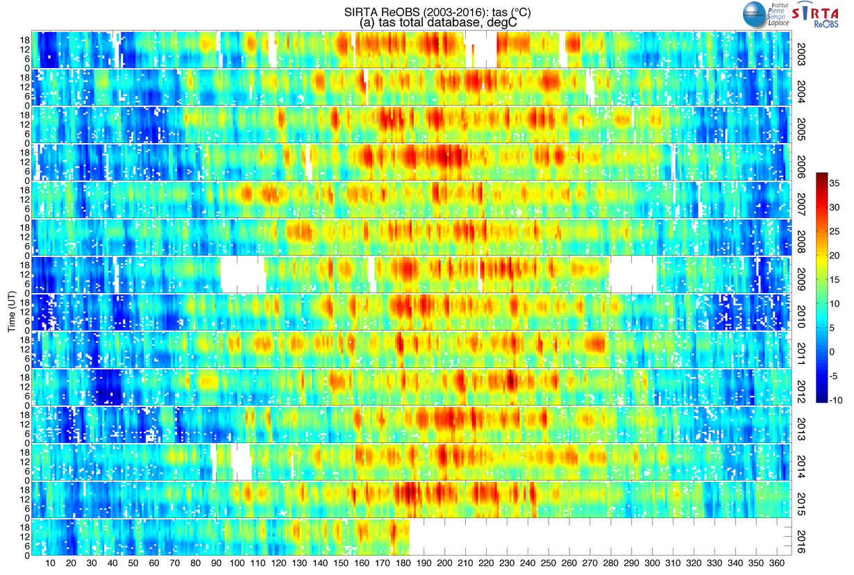
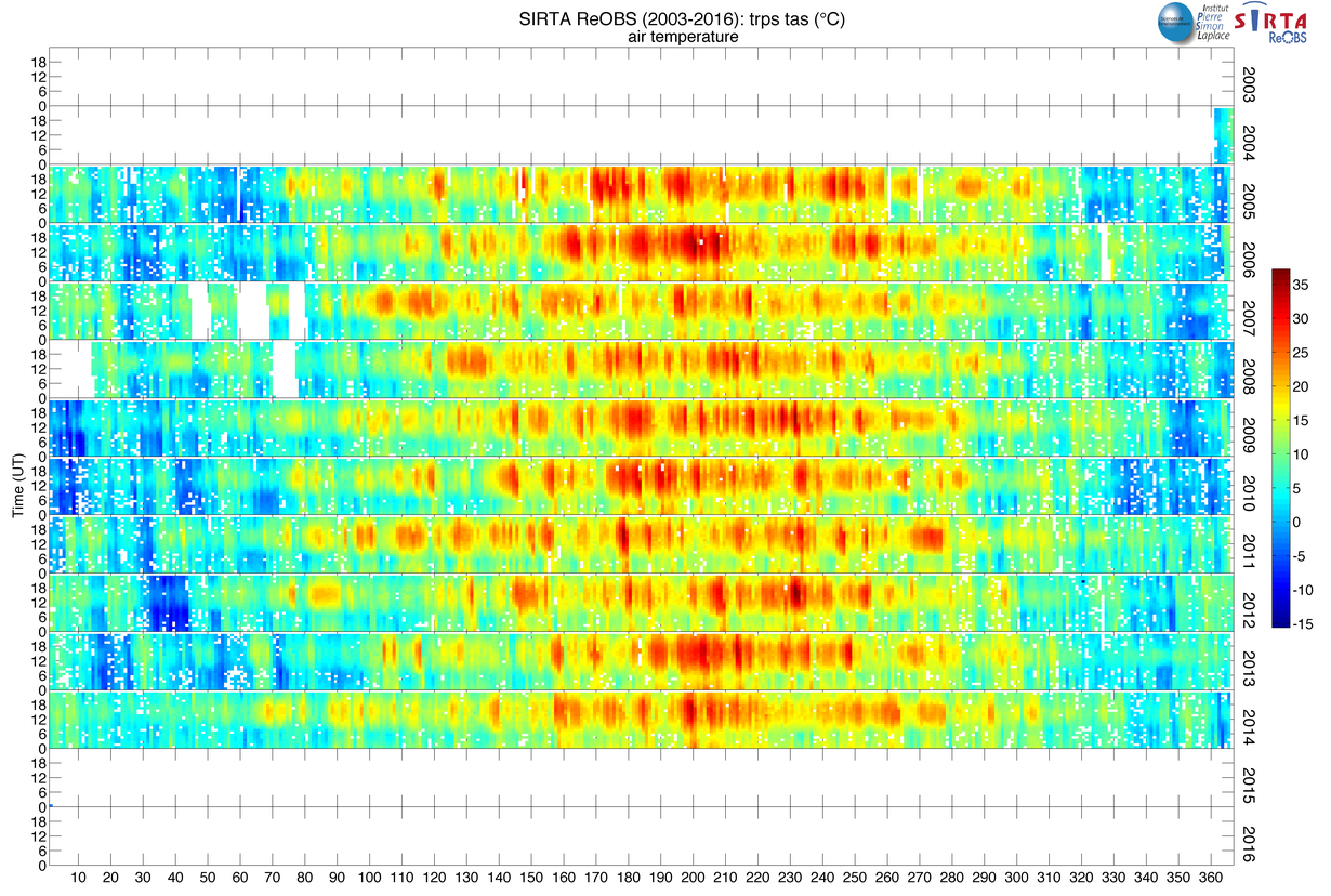
| tas_sirta | 2-m air temperature, K | 2003-2016 | -- |
| hurs_sirta | 2-m relative humidity, % | 2003-2016 | -- |
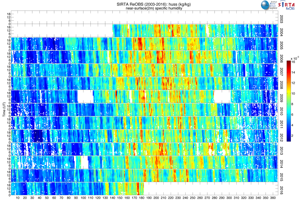
| huss_sirta | 2-m specific humidity , kg/kg | 2003-2016 | -- |
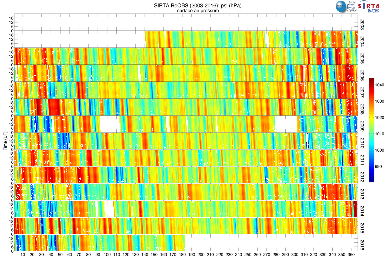
| psl_sirta | Sea-level pressure, Pa | 2003-2016 | -- |
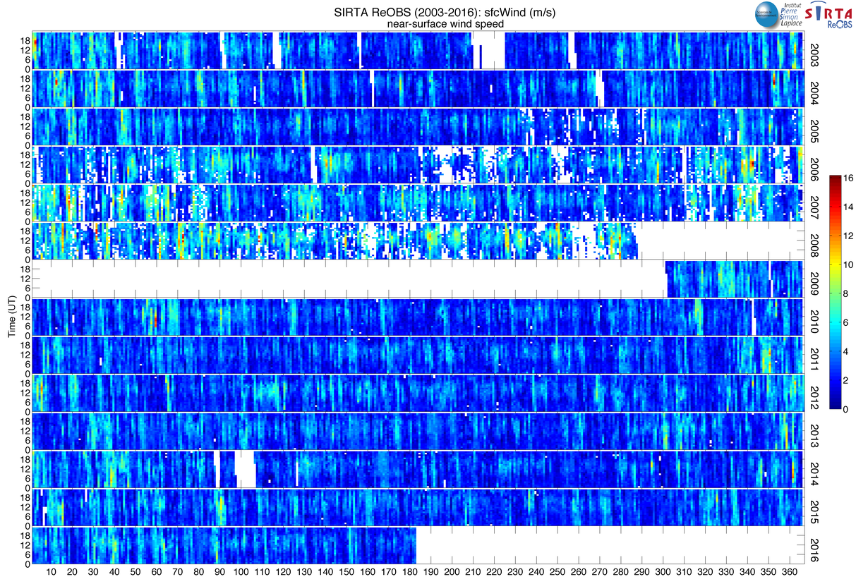
| sfcWind_sirta | 2-m wind speed, m/s | 2003-2016 | -- |
| vas_sirta | 2-m northward wind, degree | 2003-2016 | -- |
| uas_sirta | 2-m eastward wind, degree | 2003-2016 | -- |
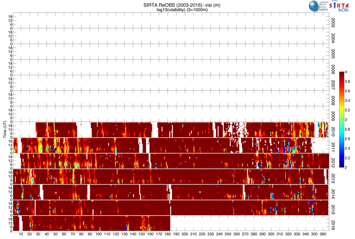
| visi_sirta | Visibility, m | 2012-2016 | -- |
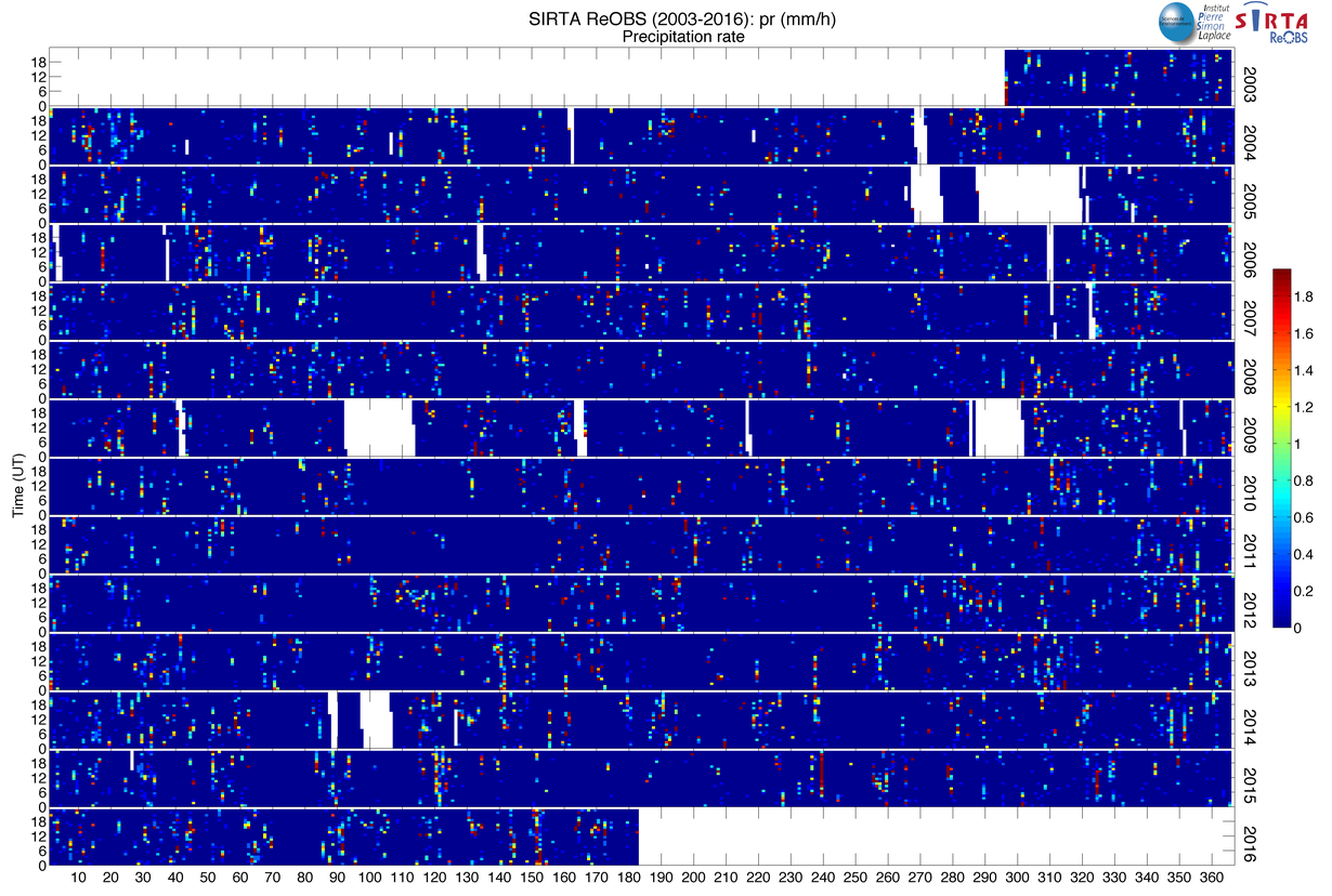
| pr_sirta | Precipitation at surface, kg/m 2/s | 2003-2014 | -- |
| tas_trps | Trappes air temperature, K | 2005-2014 | -- |
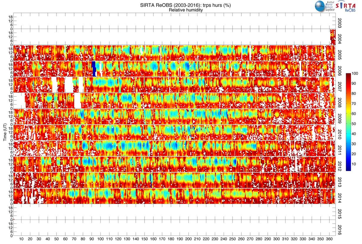
| hurs_trps | Trappes relative humidity, % | 2005-2014 | -- |
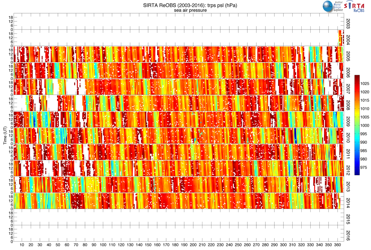
| psl_trps | Trappes Sea-level pressure, hPa | 2005-2014 | -- |
| ff_trps | Trappes wind speed, m/s | 2005-2014 | -- |
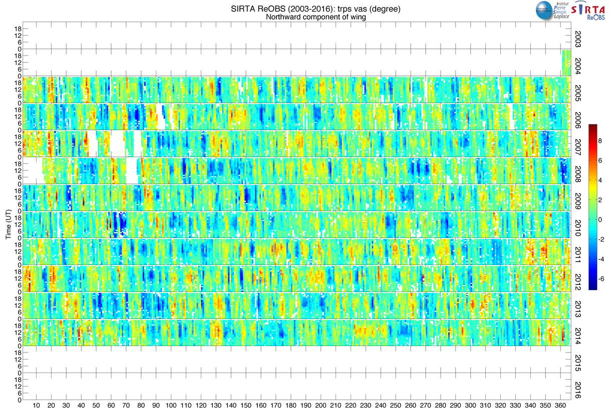
| vas_trps | Trappes northward wind, degree | 2005-2014 | -- |
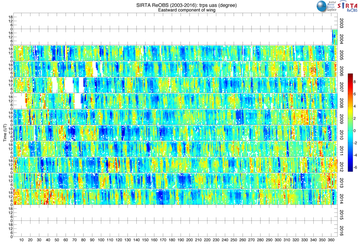
| uas_trps | Trappes eastward wind, degree | 2005-2014 | -- |
| visi_trps | Trappes Visibility, m | 2005-2014 | -- |
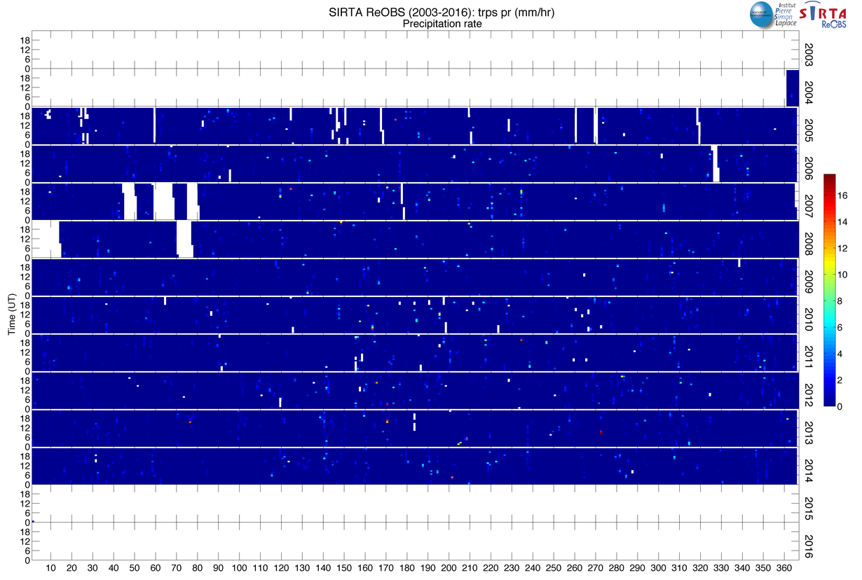
| pr_trps | Trappes Precipitation at surface, mm/hr | 2003-2014 | -- |
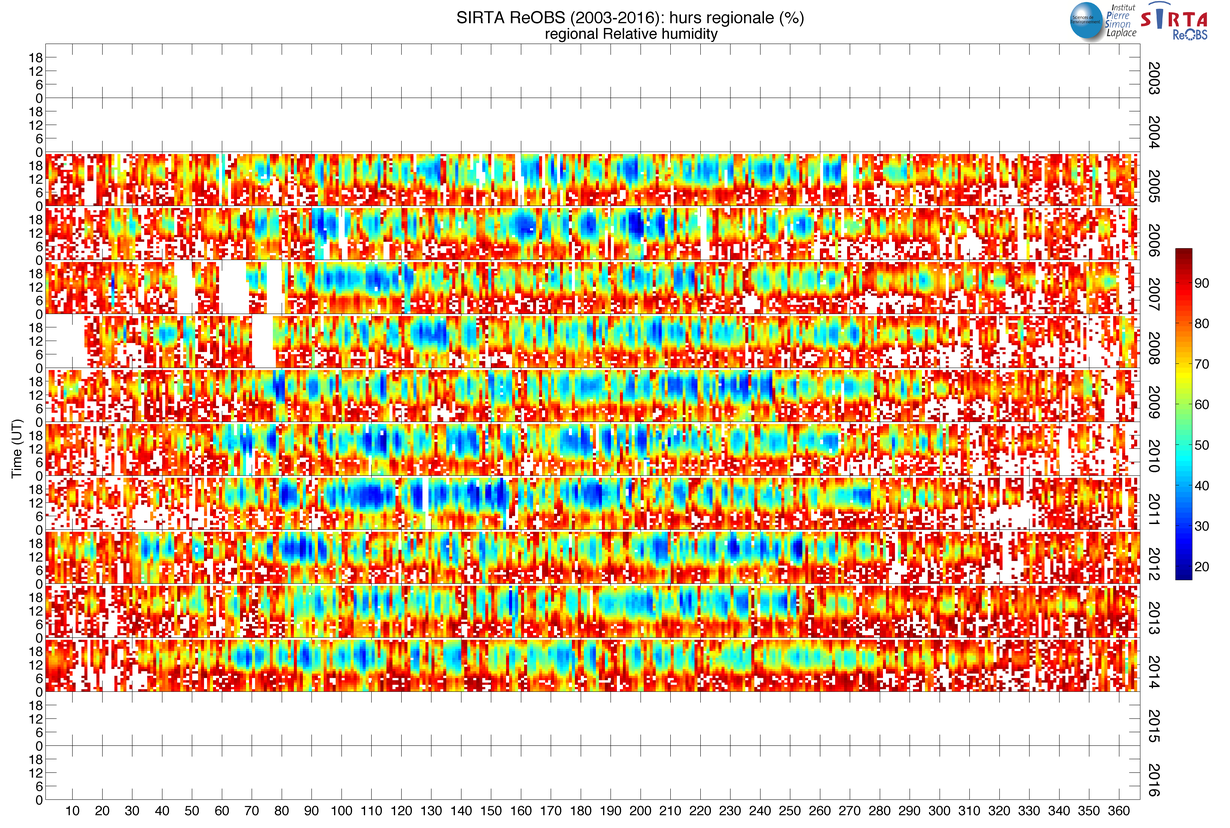
| hurs_regional | Regional relative humidity, % | 2004-2014 | -- |
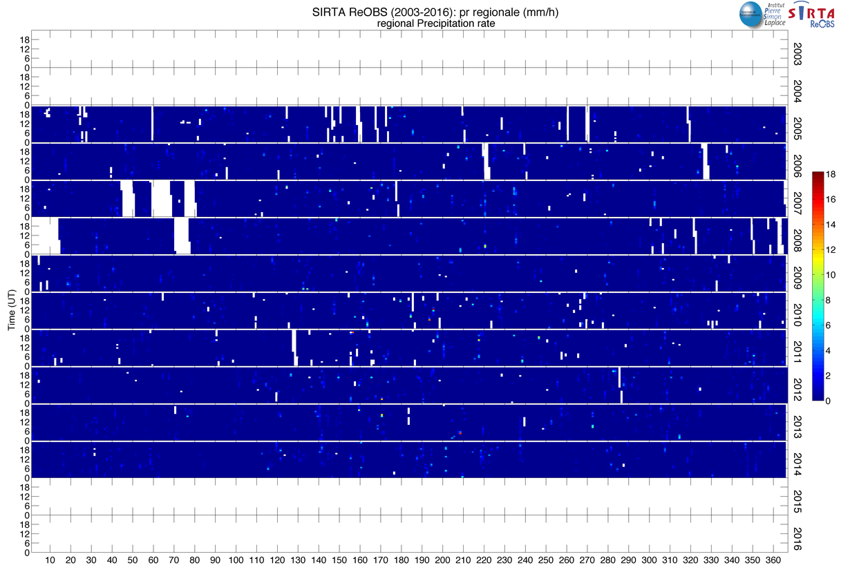
| pr_regional | Regional precipitation rate, mm/h | 2004-2014 | -- |
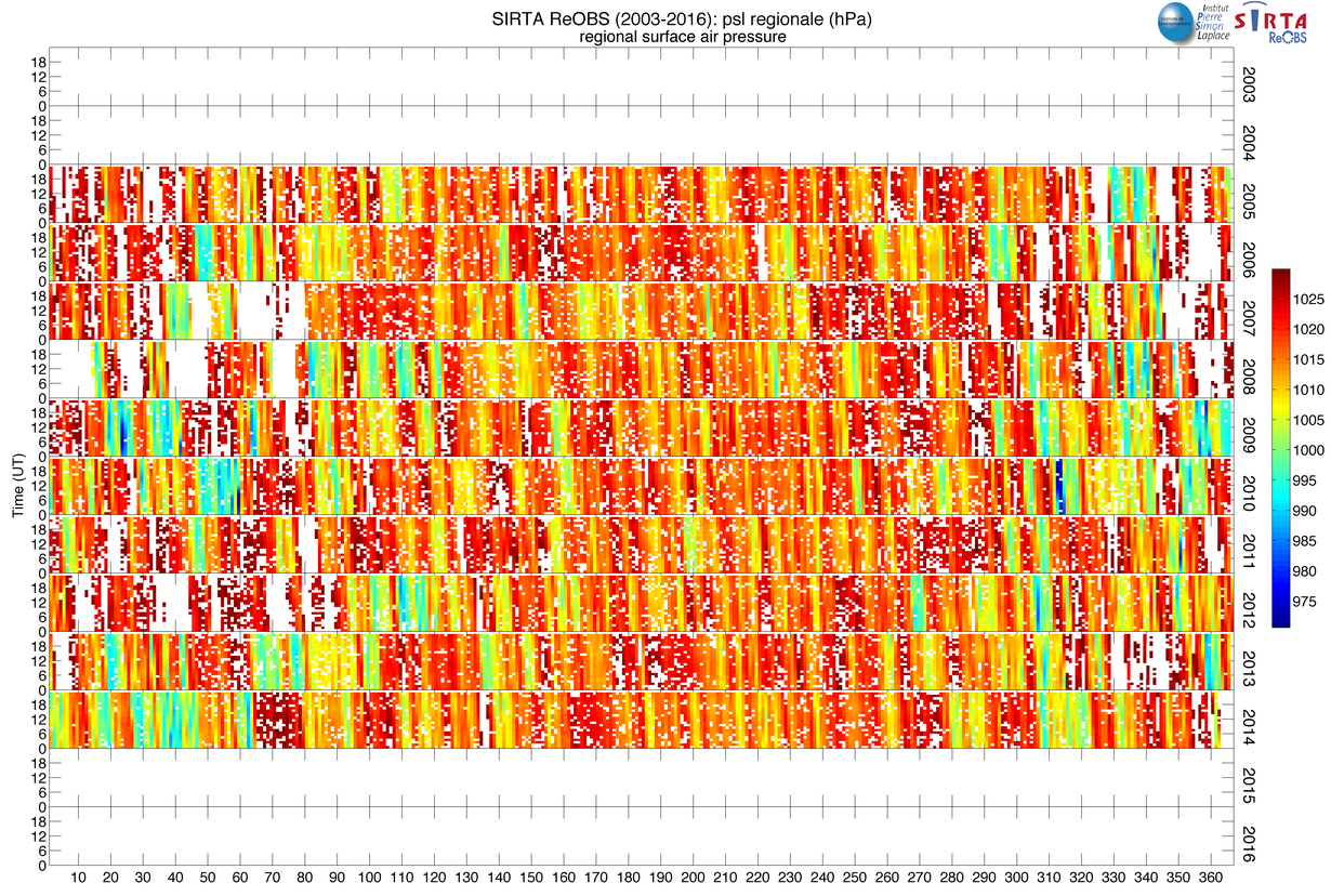
| psl_regional | Regional surface air pressure, hpa | 2004-2014 | -- |
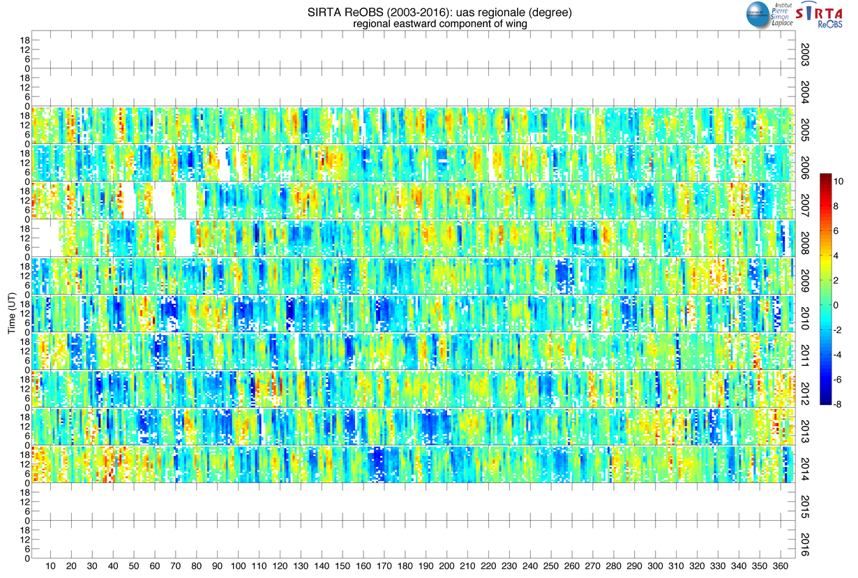
| uas_regional | Regional eastward component of wind, degree | 2004-2014 | -- |
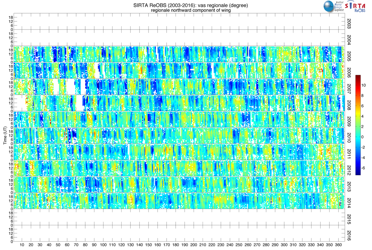
| vas_regional | Regional northward component of wind, degree | 2004-2014 | -- |
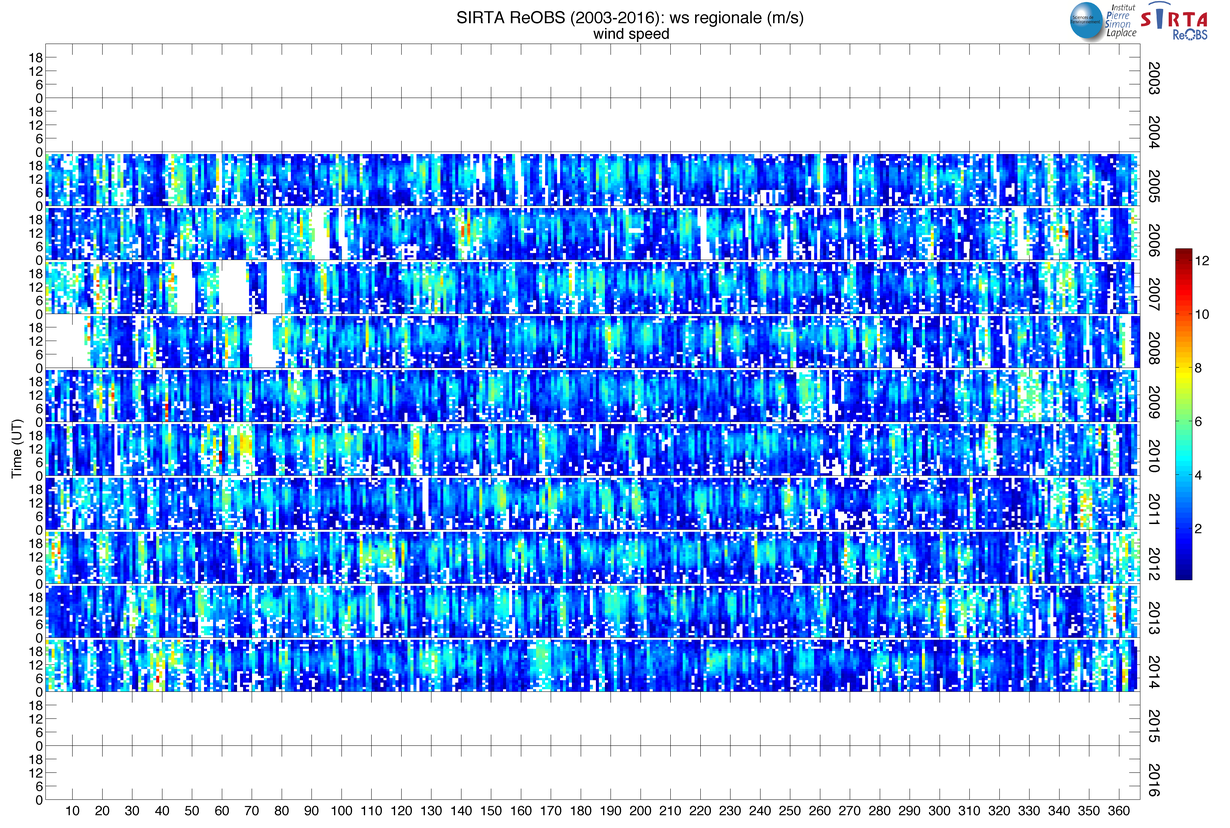
| ws_regional | Regional wind speed, m/s | 2004-2014 | -- |
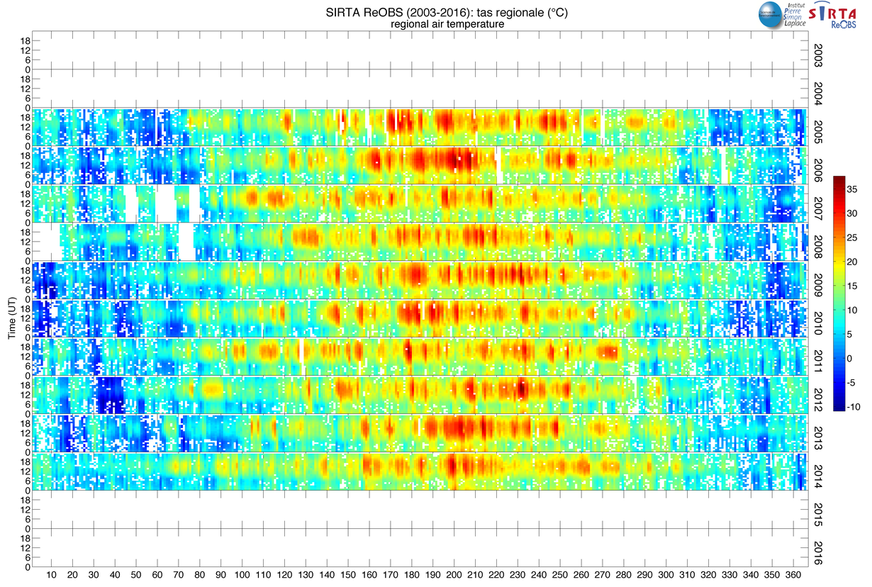
| tas_regional | Regional air temperature, K | 2004-2014 | -- |
Advanced measurements
| Variable | Description | Period of obs. | Reference |
|---|---|---|---|
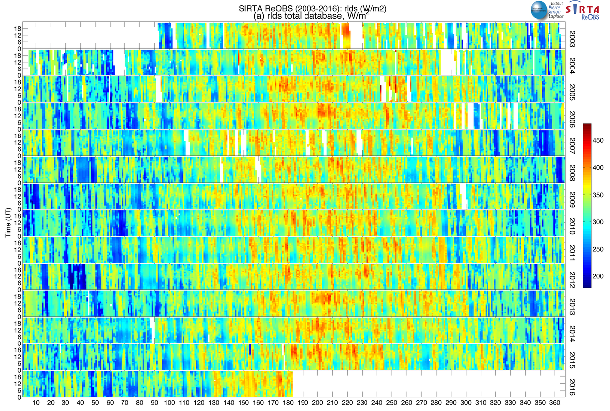
| rlds | Surface downwelling longwave radiation, W/m 2 | 2003-2016 | -- |
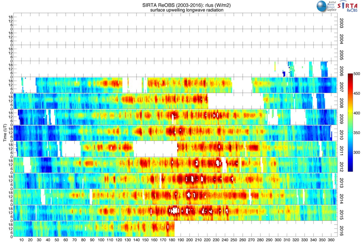
| rlus | Surface downwelling shortwave radiation, W/m 2 | 2007-2016 | -- |
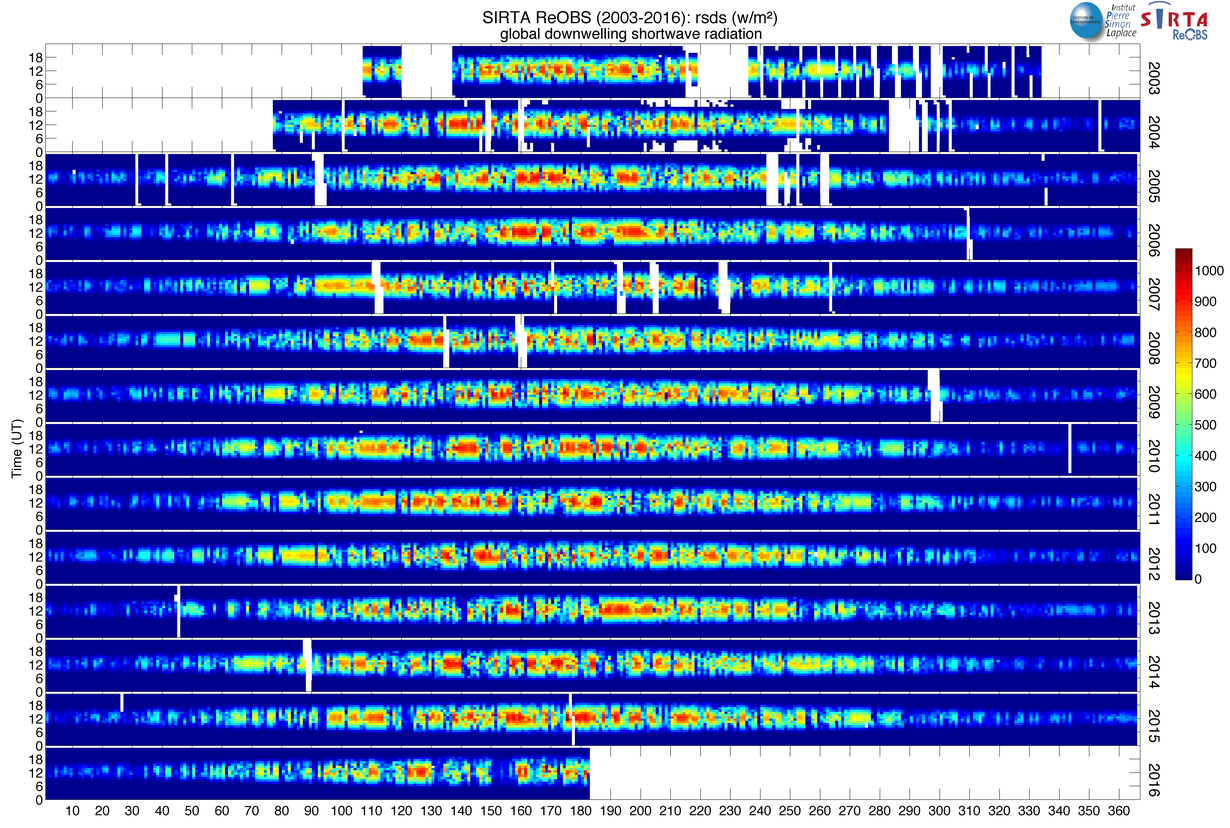
| rsds | Surface downwelling shortwave radiation, W/m 2 | 2003-2016 | -- |
| rsus | Surface upwelling shortwave radiation, W/m 2 | 2007-2016 | -- |
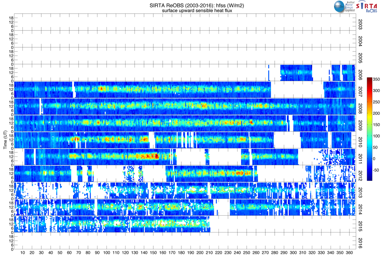
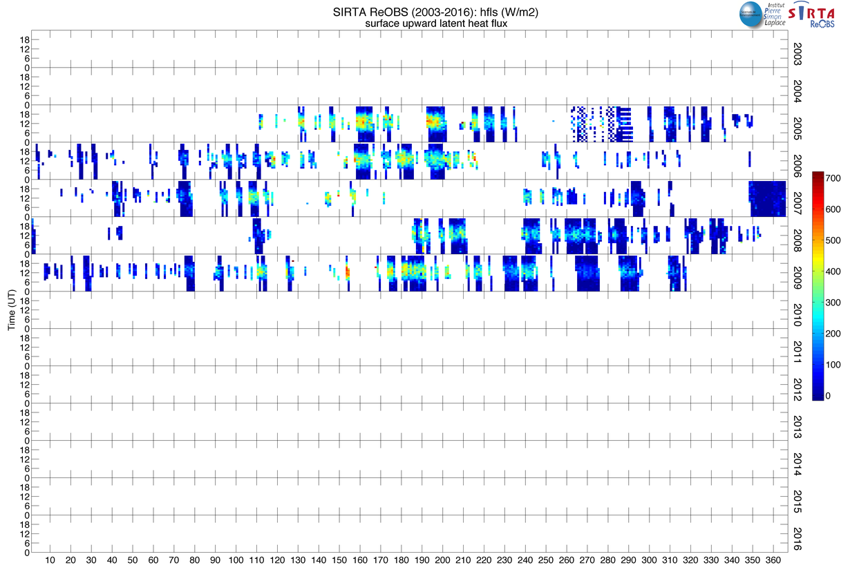
| hfs(l)s | Surface upward sensible (latent) heat flux, W/m 2 | 2006-2014 | -- |
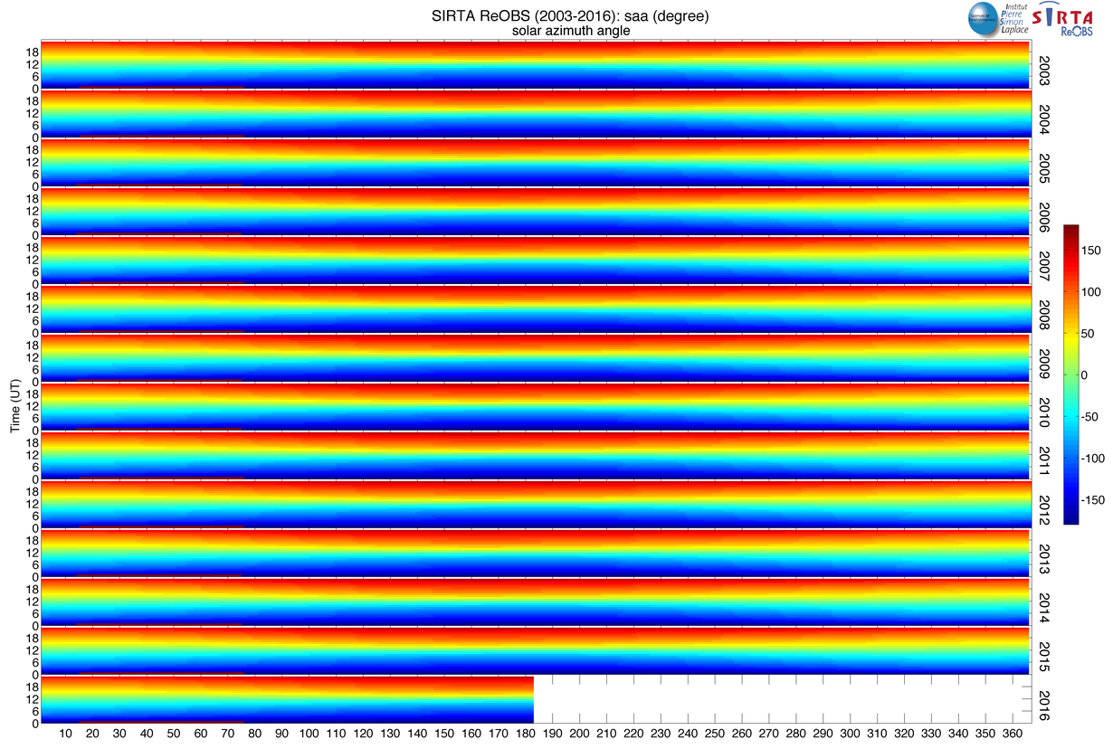
| saa | solar_azimuth_angle, degree | 2003-2015 | -- |
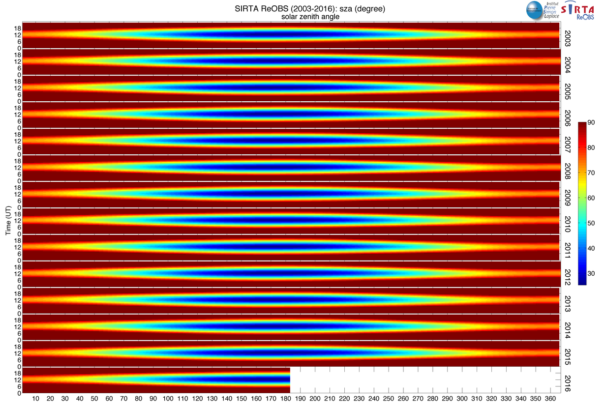
| sza | solar_zenith_angle, degree | 2003-2016 | -- |
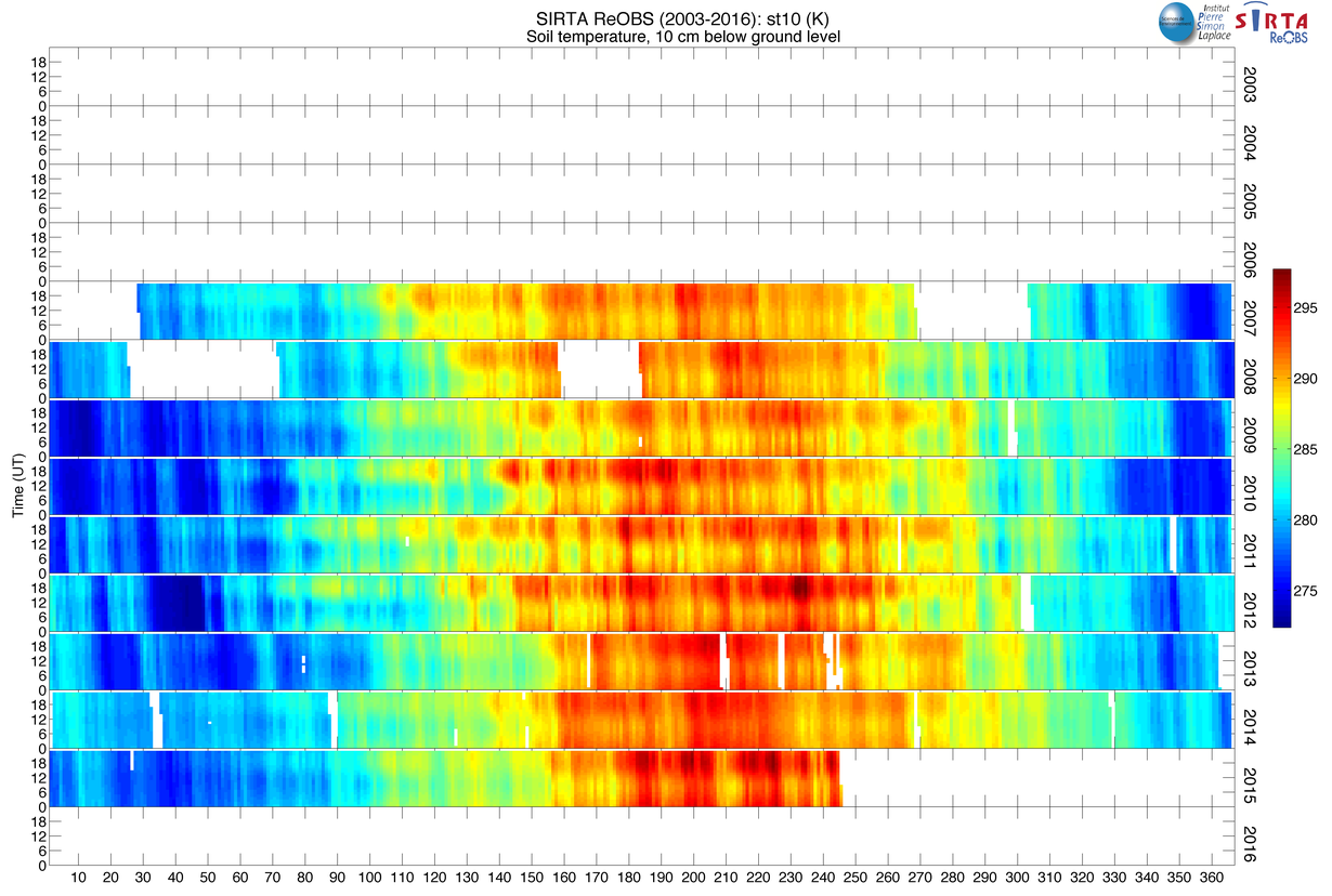
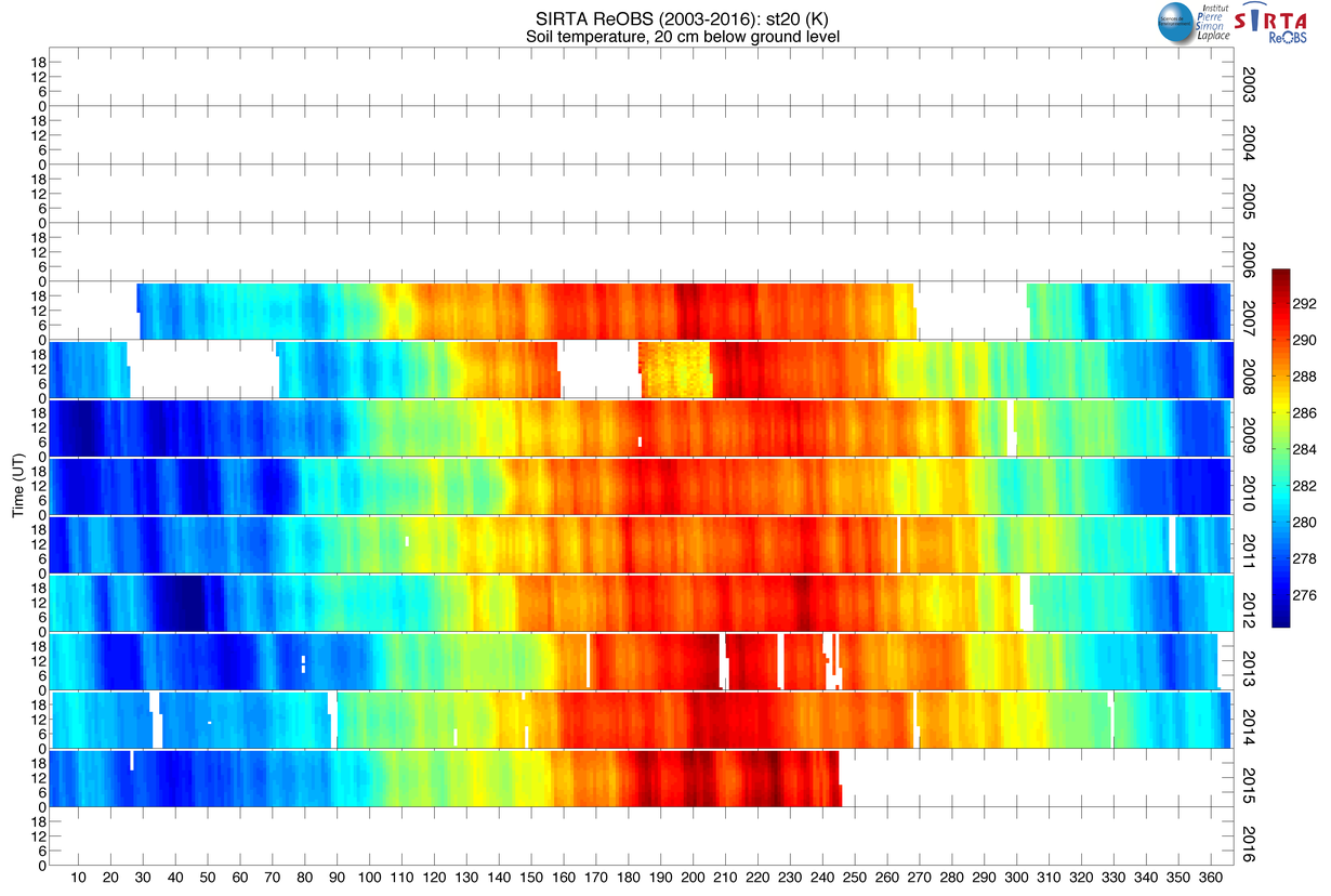
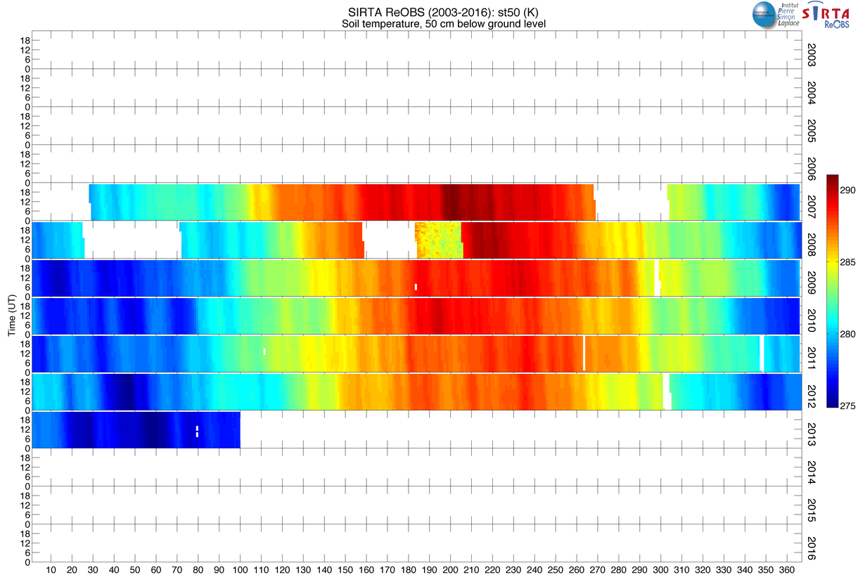
| stx 1 | Soil temperature x cm bellow ground level, K | 2007-2015 | -- |
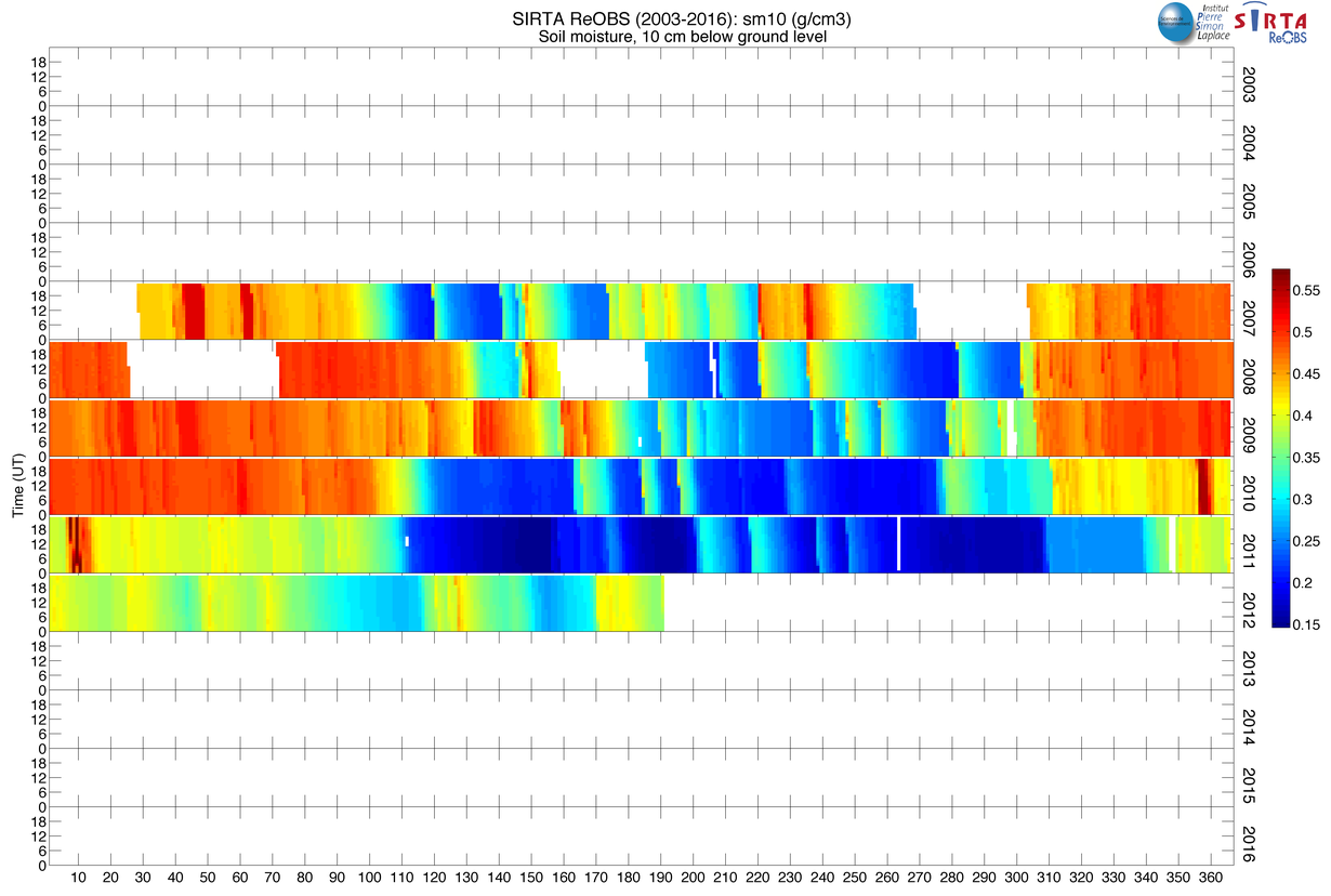
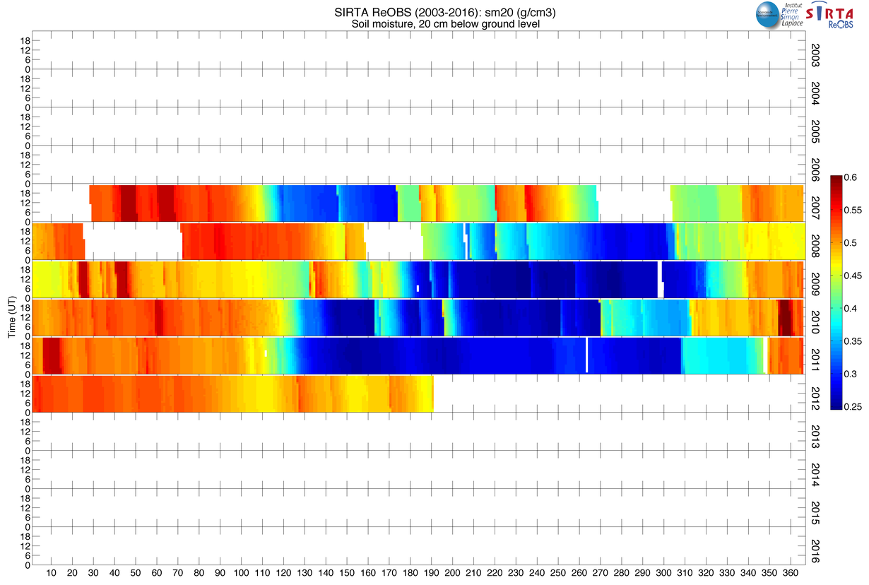
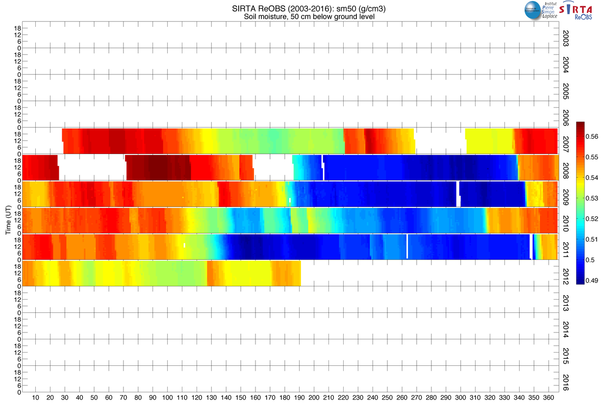
| Smx 1 | Soil moisture x cm bellow ground level, g/cm 3 | 2007-2012 | -- |
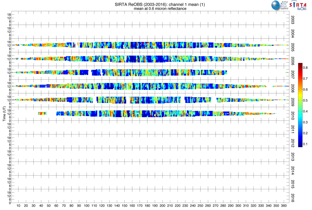
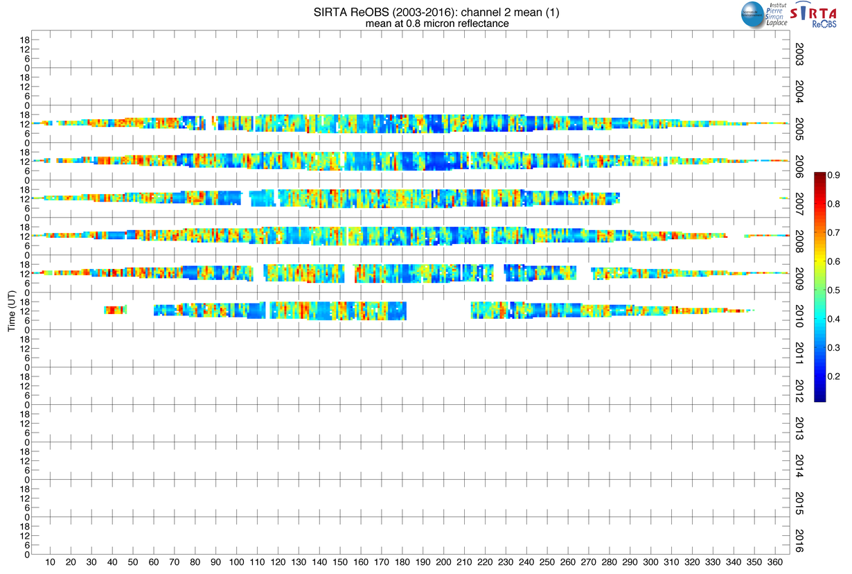
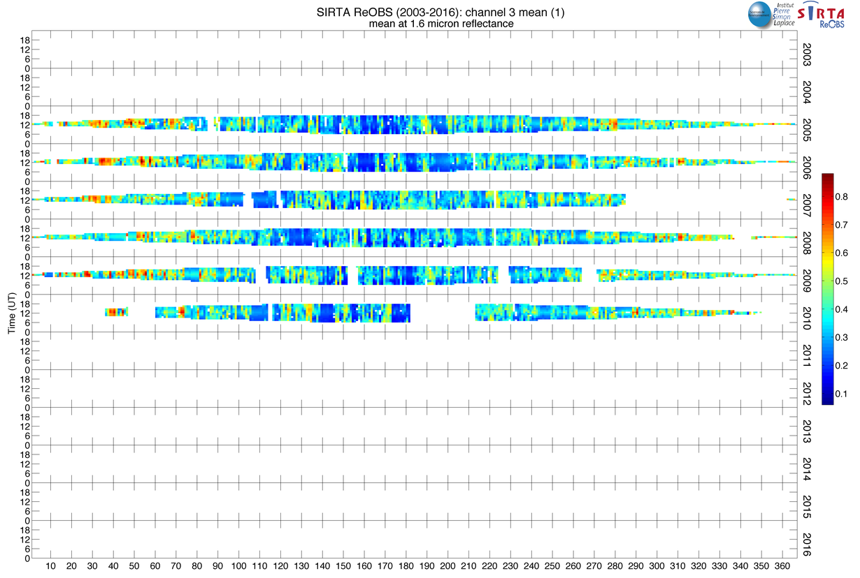
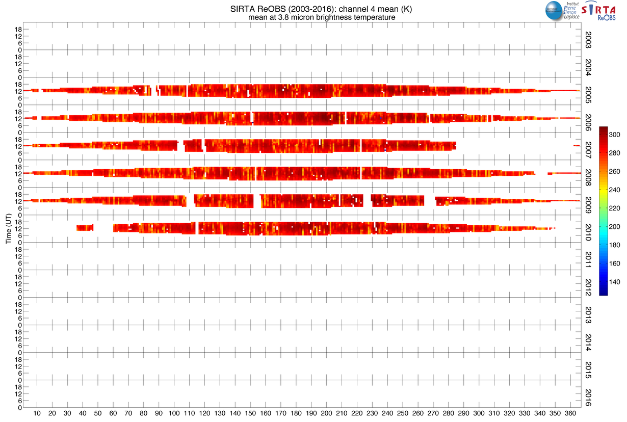
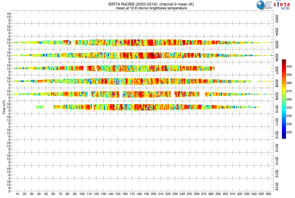
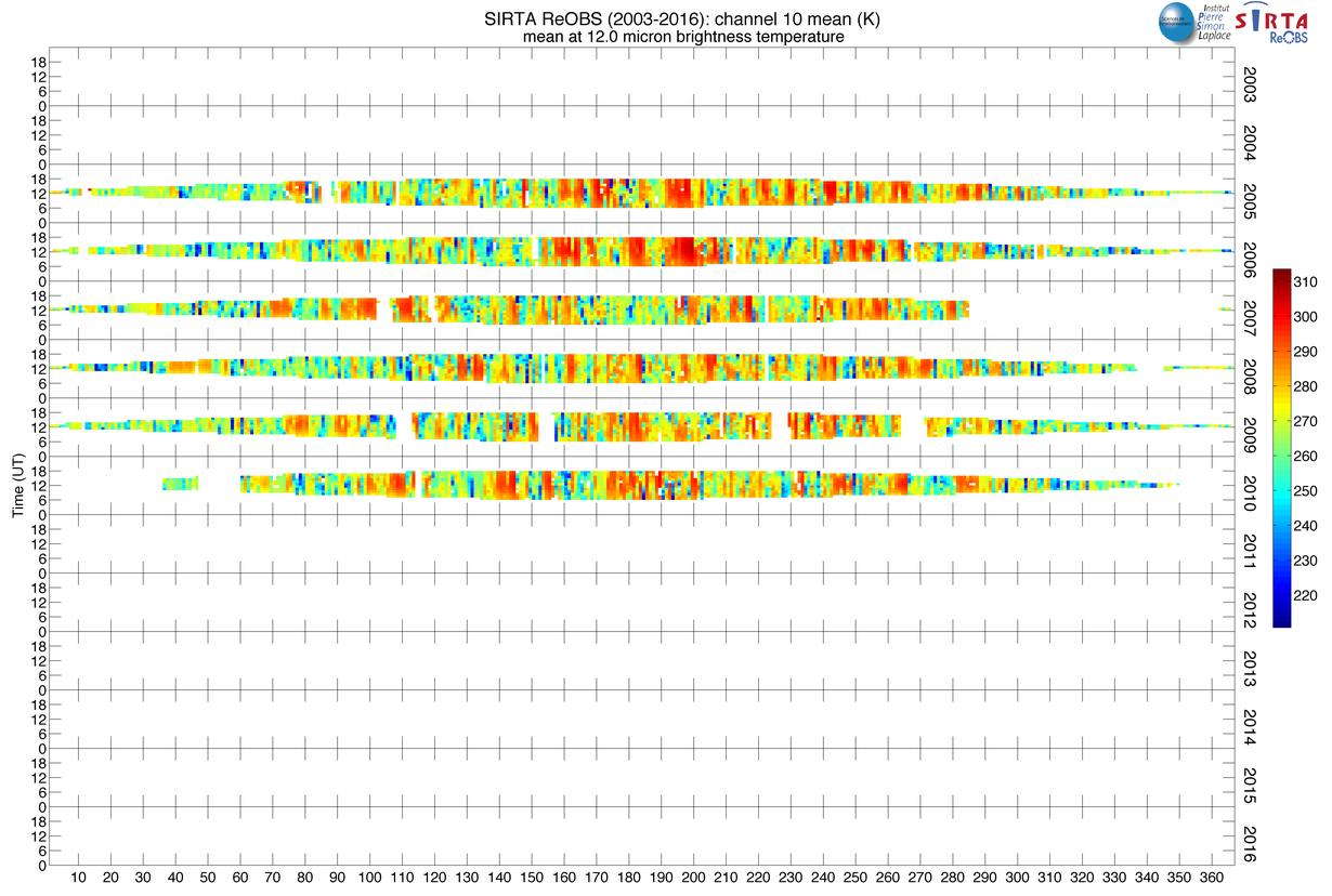
| channel_x_mean 2 | Mean brightness temperature from MSG at x µm, K | 2005-2010 | -- |
Parameters retrieved from observations
| Variable | Description | Period of obs. | Reference |
|---|---|---|---|
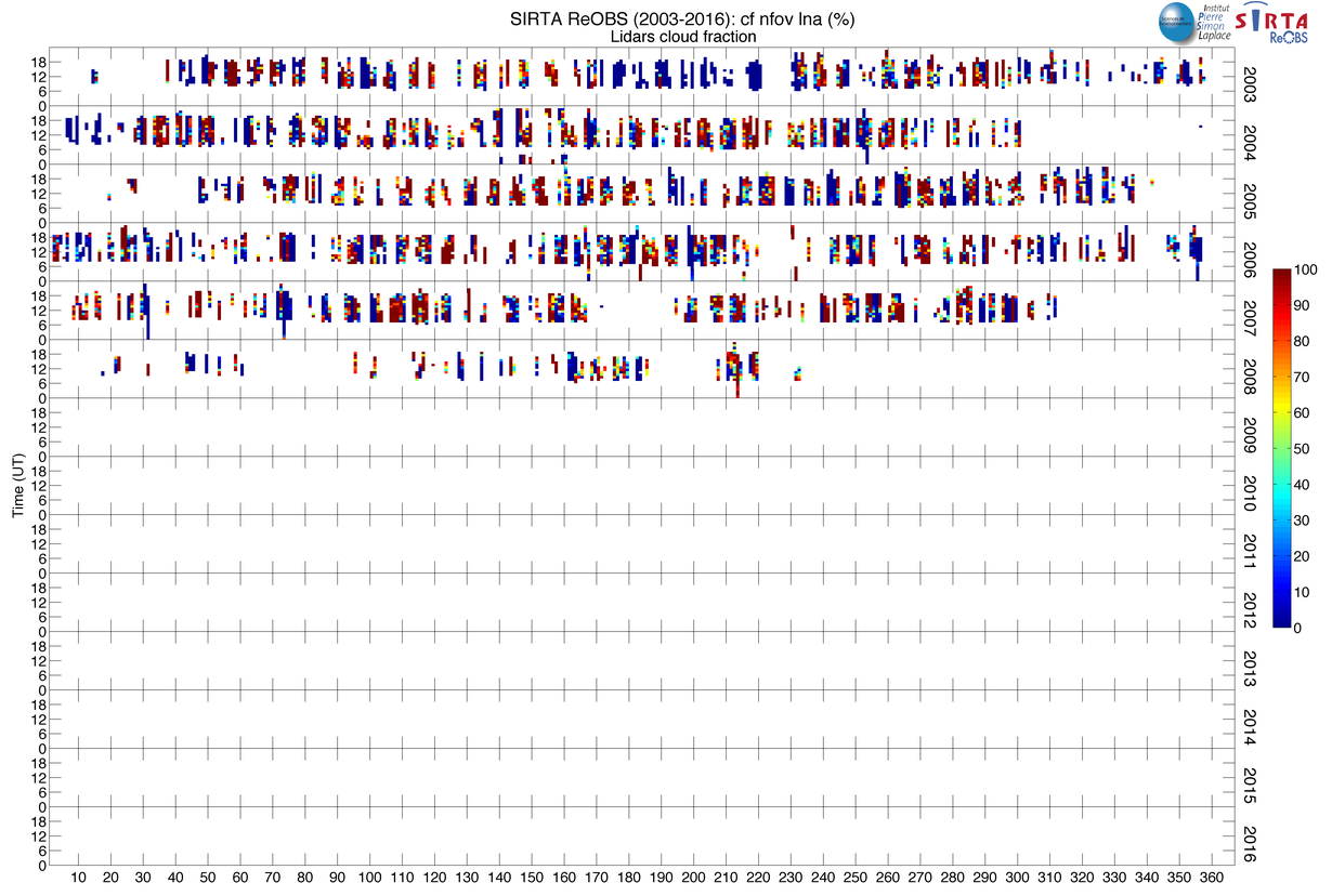
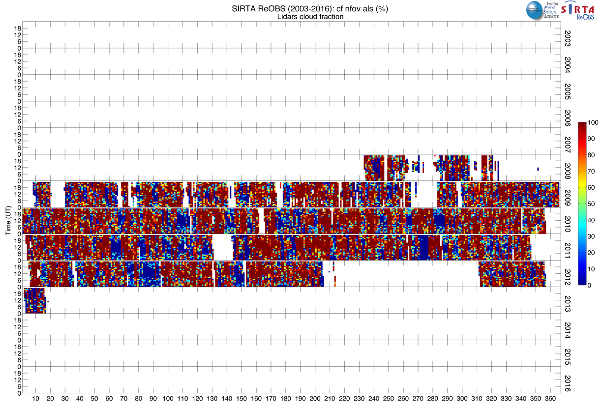
| cf_nfov_als | Lidar cloud fraction | 2008-2012 | Morille et al. 2007 |
| cf_nfov_lna | Lidar cloud fraction | 2003-2008 | Morille et al. 2007 |
| rsdscs | Surface downwelling shortwave radiation for clear sky, W/m 2 | 2003-2015 | Long et al. 2006 |
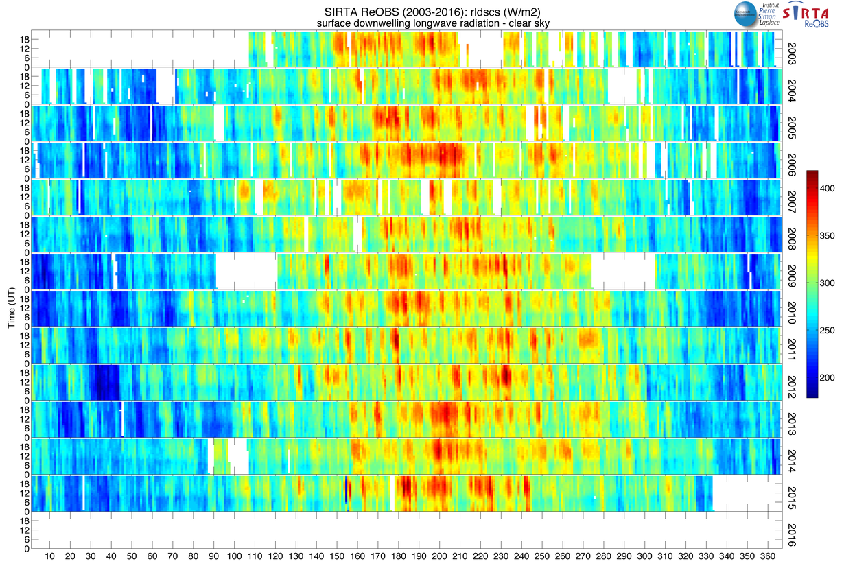
| rldscs | Surface downwelling longwave radiation for clear sky, W/m 2 | 2003-2015 | Long et al. 2006 |
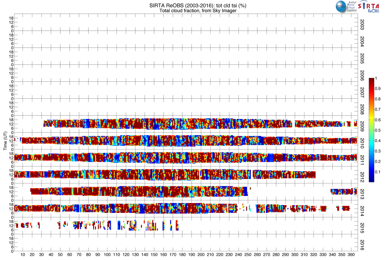
| tot_cld_tsi | Cloud fraction from sky imager | 2009-2014 | -- |
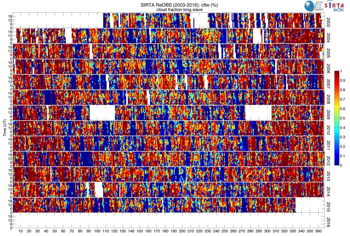
| cflw | Cloud fraction from longwave radiation | 2003-2014 | Long et al. 2006 |
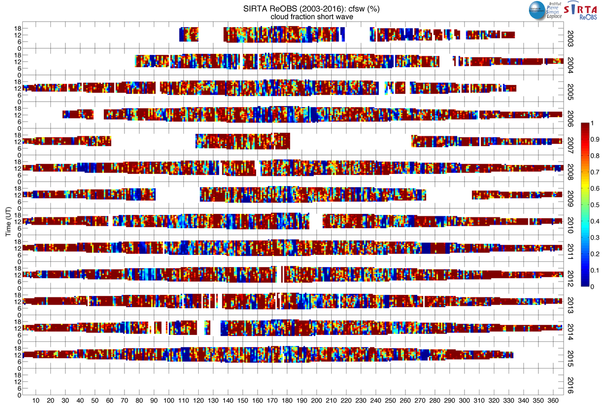
| cfsw | Cloud fraction from shortwave radiation | 2003-2014 | Long et al. 2006 |
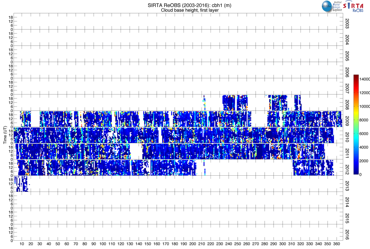
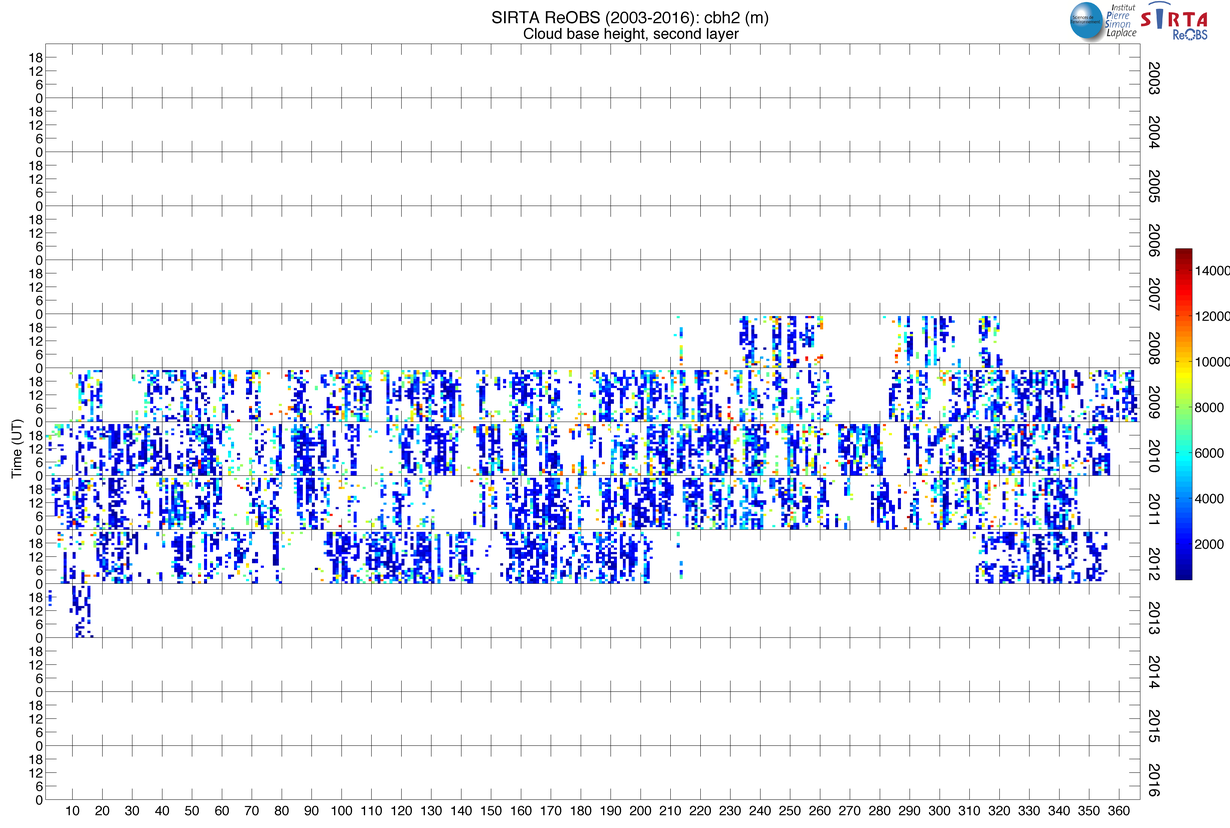
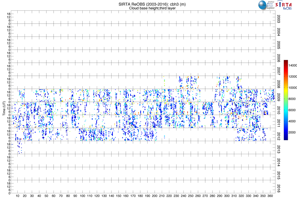
| cbhx 3 | Lidar cloud base heigh, m | 2008-2013 | Morille et al. 2007 |
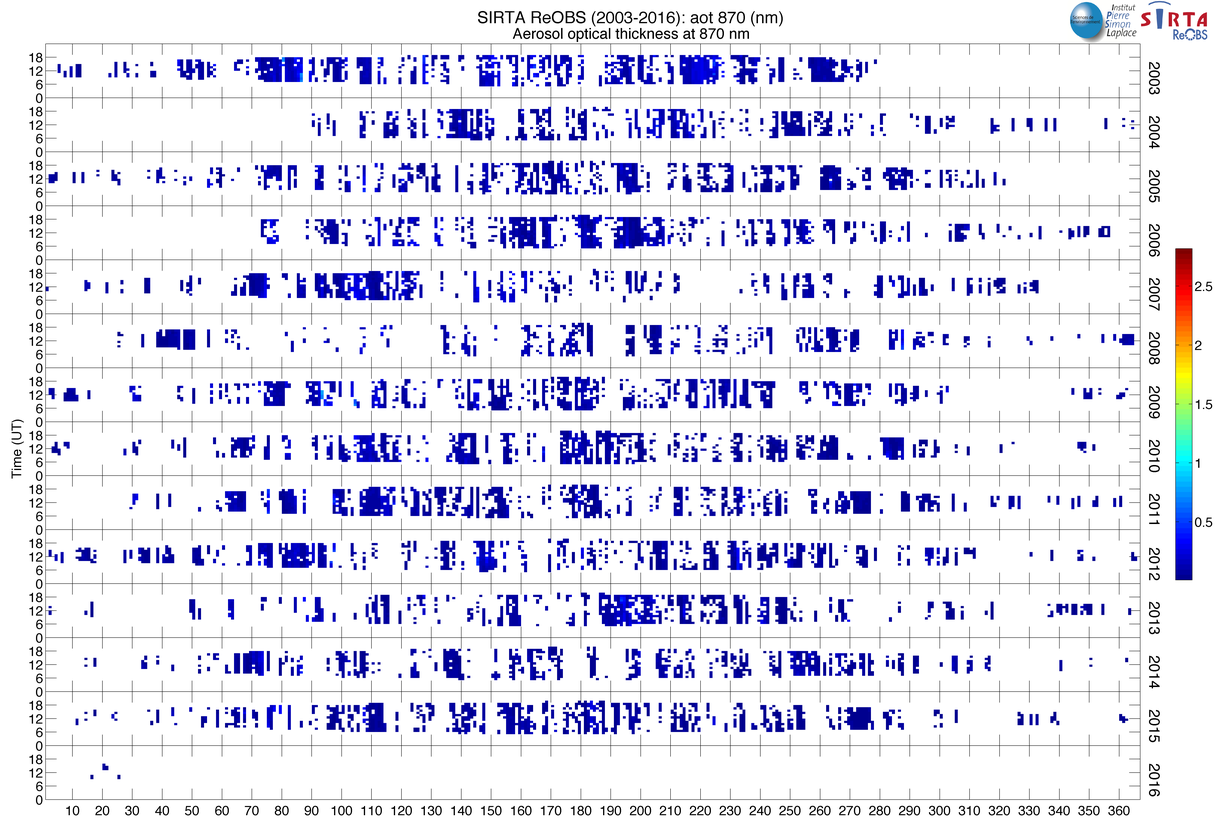
| aot_x 4 | Aerosol optical thickness at x nm | 2008-2014 | Aeronet |
| water | Clear sky integrated watr vapor, kg/m 2 | 2008-2014 | Aeronet |
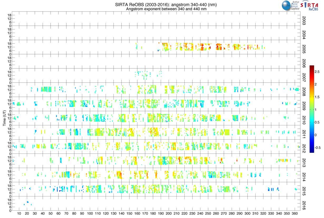
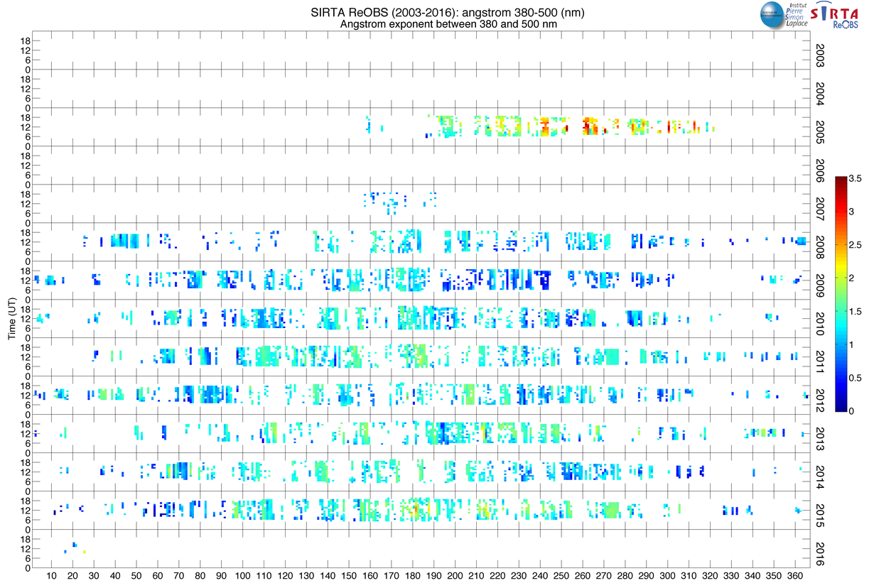
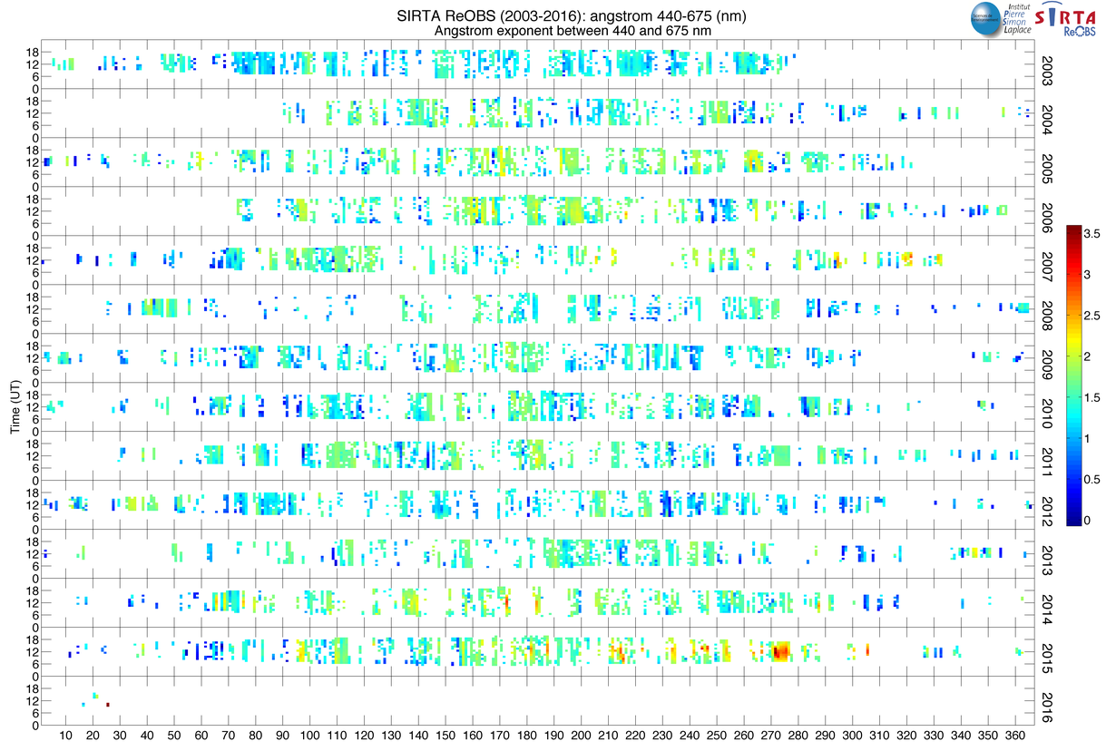
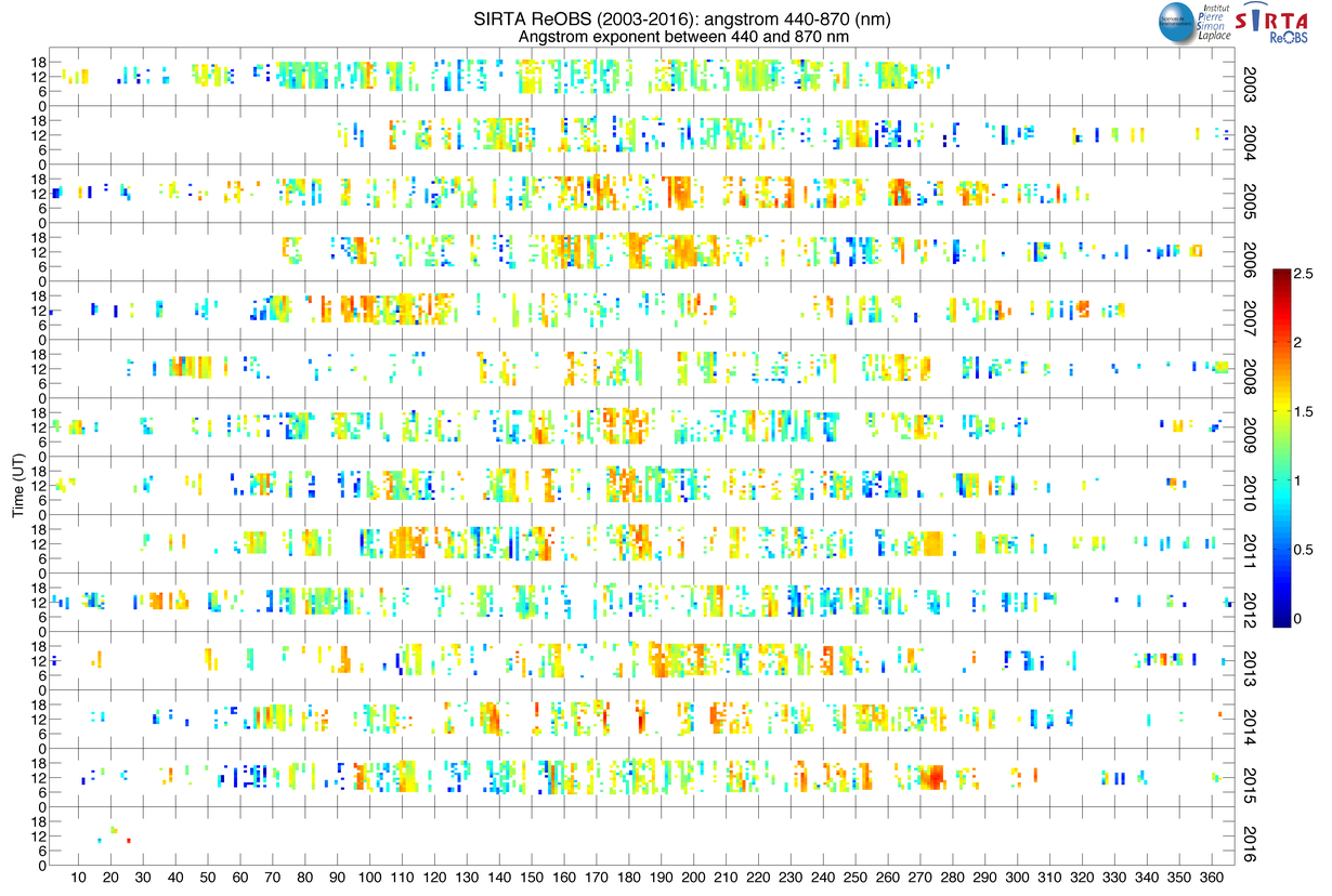
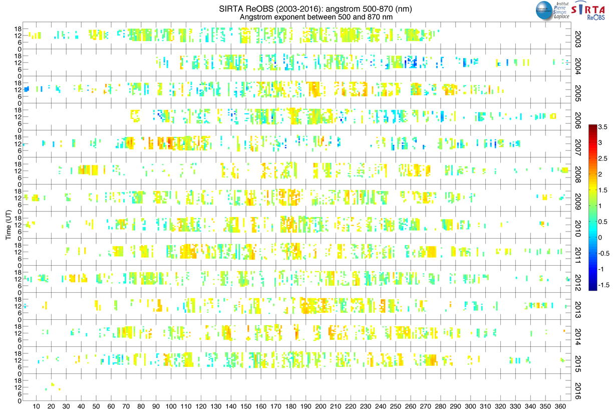
| angstrom_x-y 5 | Angstrom exponent between x and y nm, nm | 2008-2014 | Aeronet |
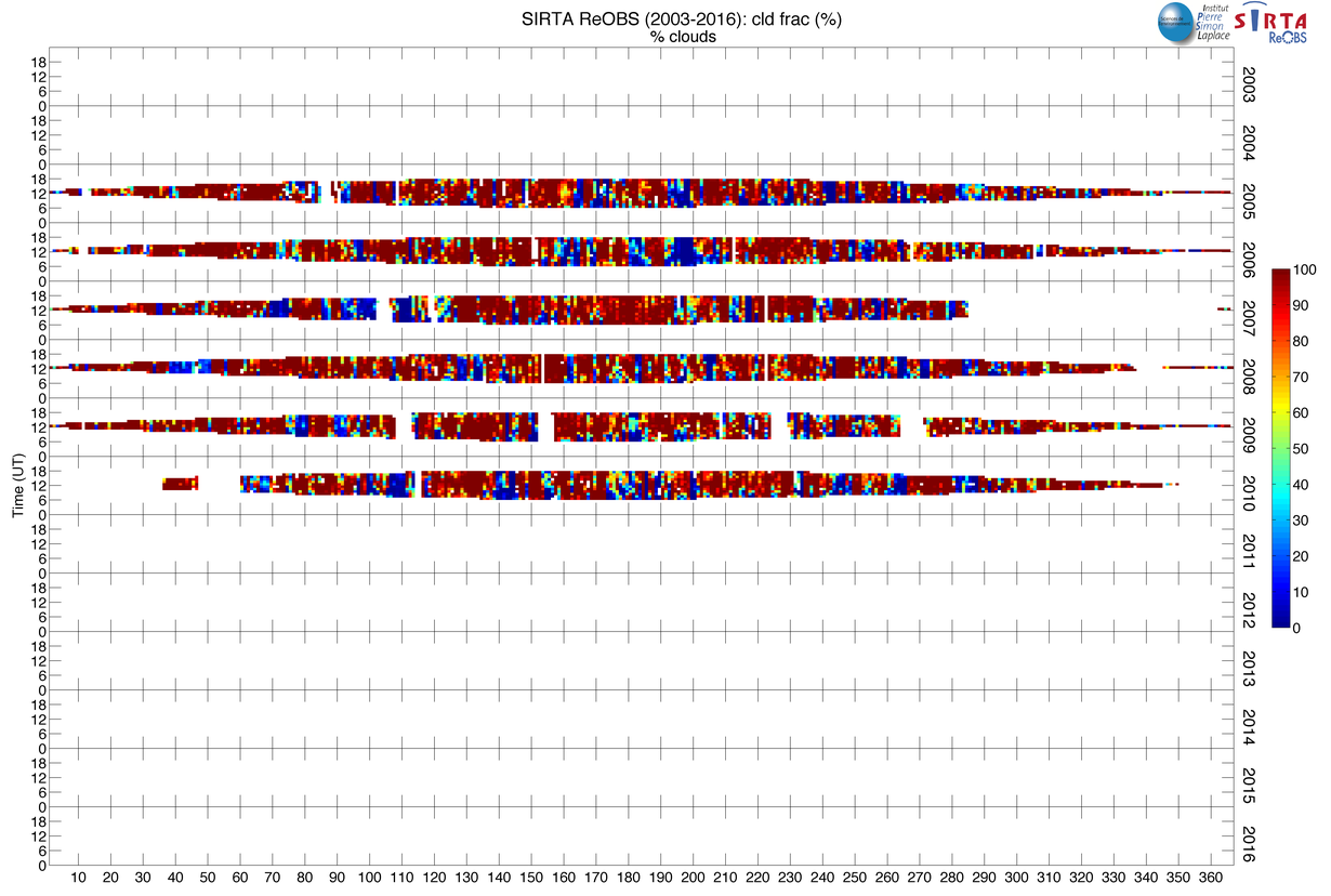
| cld_frac | Percentage cloudy pixels over 15x15 pixels | 2005-2010 | Roebeling et al. 2006 |
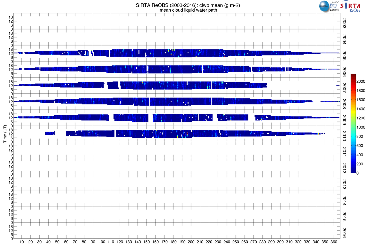
| clwp_mean | Mean cloud liquid water path over 15x15 pixels, g/m 2 | 2005-2010 | Roebeling et al. 2006 |
| ctt_mean | Mean cloud top temperature over 15x15 pixels, K | 2005-2010 | Roebeling et al. 2006 |
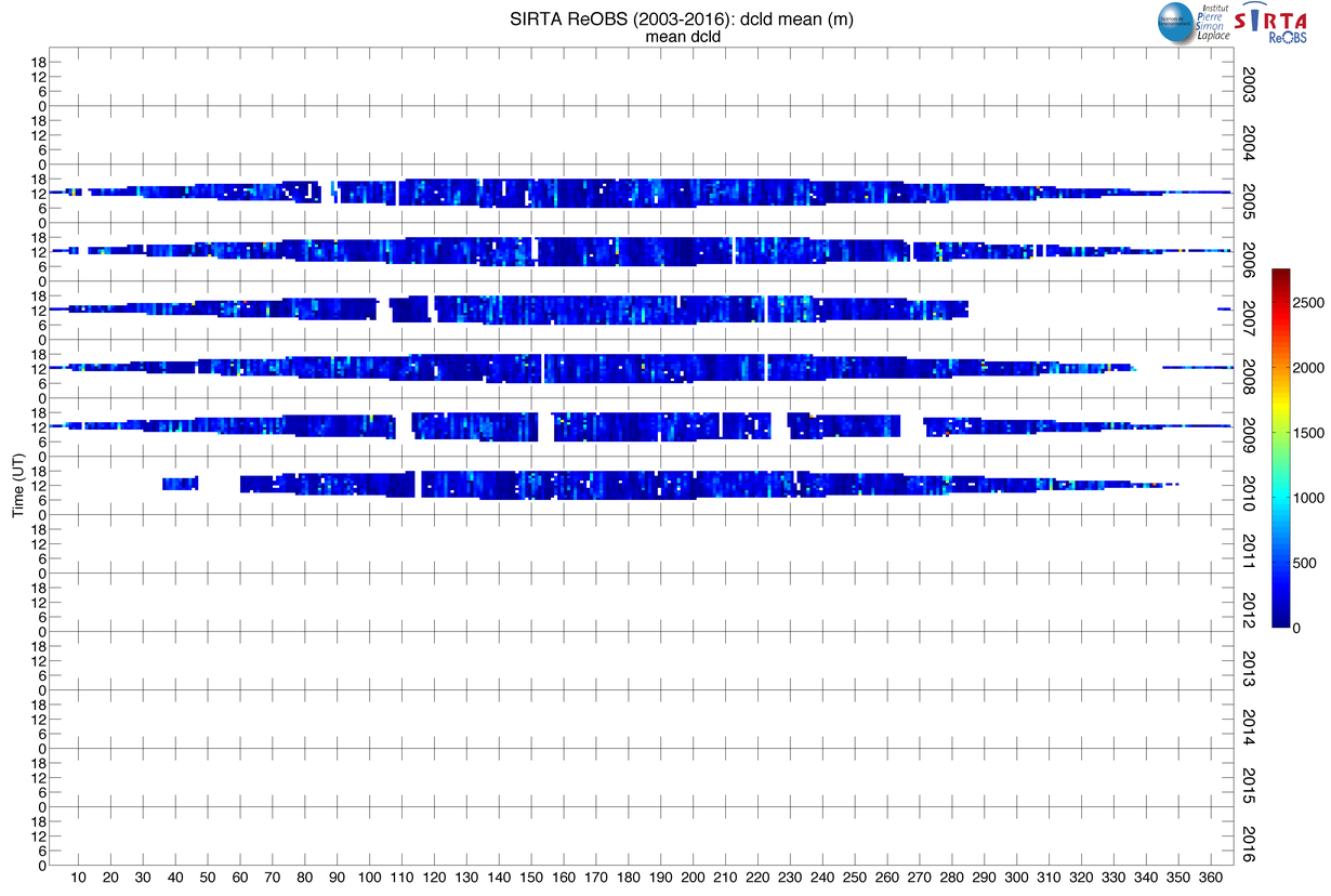
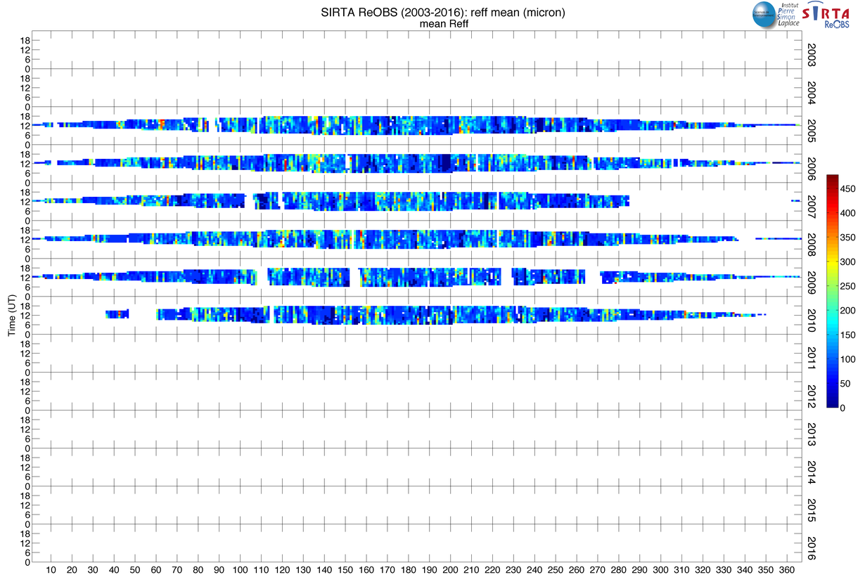
| reff_mean | Mean cloud effective radius over 15x15 pixels, mm | 2005-2010 | Roebeling et al. 2006 |
| tau_mean | Mean cloud optical thickness over 15x15 pixels, g/m 2 | 2005-2010 | Roebeling et al. 2006 |
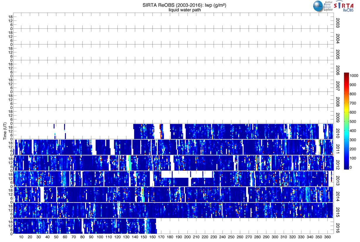
| lwp | Liquid_water_path, g/m 2 | 2012-2016 | -- |
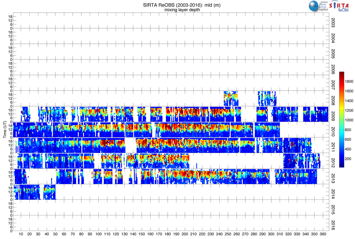
| mld | Mixing_layer_depth, m | 2008-2014 | -- |
| iwv | Integrated water vapor, Kg/m 2 | 2006-2016 | -- |
Vertical lidar measurements
| Variable | Description | Period of obs. | Reference |
|---|---|---|---|
| SRhisto | Lidar scaterring ratio vertical histograms | 2003-2015 | -- |
| STARThisto | Lidar STRAT classification vertical histograms | 2003-2015 | Morille et al. 2007 |
| pr2_mol | Lidar molecular profile | 2003-2015 | -- |
| norm_height | Altitude of normalisation of lidar profiles, m | 2003-2015 | -- |
1x is 5 cm, 10 cm, 20 cm, 30 cm, 50 cm.
2x is 12, 0.6, 0.8, 1.6, 3.8, 10.8 µm.
3x is first layer (1), second layer (2), third layer (3)
4x is 1020, 870, 675, 500, 440, 380, 340 nm.
5x and y are the interval between 4 values.
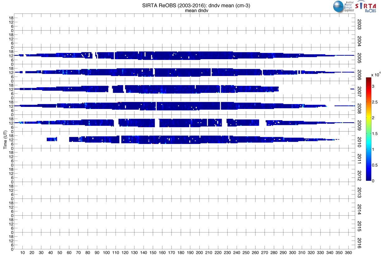
Parameters currently included in SIRTA-ReOBS. First block is for classical meteorological
measurements, second block is for more advanced measurements, third block is for parameters
retrieved from observations, fourth block is for vertical lidar measurements.

SIRTA-ReOBS content at 2015-06; about 50 parameters, 2003 – 2015 for the oldest data.


Scientific manager:
Scientific support:
Technical support:
SIRTA-ReOBS is free access
If you publish with SIRTA-ReOBS, please contact us. Depending on the type of use, we will indicate you wich one of these solutions is adapted:
- simple use that do not require our expertise: mention SIRTA-ReOBS publications, and acknowledgements.
- intensive use that require our expertise: one of SIRTA-ReOBS scientist is associated to your publication and brings its expertise: Marjolaine Chiriaco, Jean-Charles Dupont, Jordi Badosa, or Martial Haeffelin. See Contact tab.
sirta-ReOBS file 200301-201712
Download
sirta-ReOBS file without lidar profiles 200301-201712
Download
version V1-2-1
New variables added :
- Trappes radiosounding profiles measurements ("_RS" sufix)
version V1-1-1
New variables added :
- Trappes classical meteorological measurements ("trps_" prefix)
- Integrated water vapor calculate by GPS system (iwv)
- Regional meteorolgy ("_regional" suffix)
Variables modified :
- Variable cf_nfov splited in two variables :
| Variable name | Description | Period |
|---|---|---|
| cf_nfov_als | Cloud fraction from als(Aerosol Lidar System) at 355 nm | 2008-2012 |
| cf_nfov_lna | Cloud fraction from lna(Lidar Nouages Aerosols) at 532 and 1064 nm | 2003-2008 |
Renamed variables :
| Old variable name | New variable name |
|---|---|
| mu_fclw | std_fclw |
| mu_cfsw | std_cfsw |
| mu_hfls | std_hfls |
| mu_hfss | std_hfss |
| mu_hurs | std_hurs |
| mu_huss | std_huss |
| mu_ps | std_ps |
| mu_psl | std_psl |
| mu_rlds | std_rlds |
| mu_rlus | std_rlus |
| mu_rsdscs | std_rsdscs |
| mu_rsus | std_rsus |
| mu_sfcWind | std_sfcWind |
| mu_sm5 | std_sm5 |
| mu_sm10 | std_sm10 |
| mu_sm20 | std_sm20 |
| mu_sm50 | std_sm50 |
| mu_st5 | std_st5 |
| mu_st10 | std_st10 |
| mu_st20 | std_st20 |
| mu_st50 | std_st50 |
| mu_solar_zenith_angle | std_solar_zenith_angle |
| mu_tas | std_tas |
| mu_tot_cld_tsi | std_tot_cld_tsi |
| mu_uas | std_uas |
| mu_vas | std_vas |
| mu_water | std_water |
| mu_cflw | std_cflw |
| mu_rldscs | std_rldscs |
| d_lwp | std_lwp |
| d_prp | std_prp |
| d_reff | std_reff |
| d_sds | std_sds |
| d_tau | std_tau |
| d_visi | std_visi |
| 340-440angstrom | angstrom_340-440 |
| 380-500angstrom | angstrom_380-500 |
| 440-675angstrom | angstrom_440-675 |
| 440-870angstrom | angstrom_440-870 |
| 500-870angstrom | angstrom_500-870 |
| sfcWind | sfcWind_sirta |
| tas | tas_sirta |
| hurs | hurs_sirta |
| huss | huss_sirta |
| pr | pr_sirta |
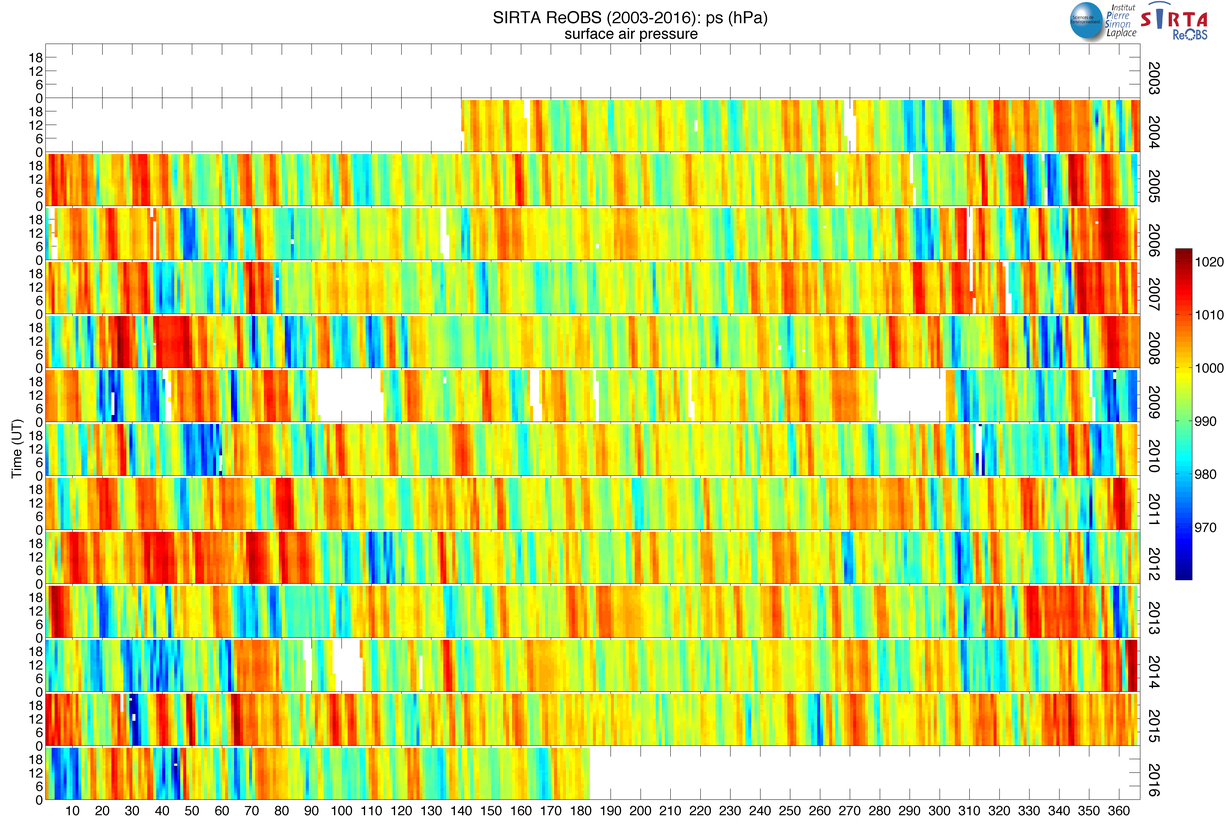
| ps | ps_sirta |
| psl | psl_sirta |
| uas | uas_sirta |
| vas | vas_sirta |
| visi | visi_sirta |
Deleted variables :
- Spatial Uncertainty variables
| Old variable name |
|---|
| su_hurs |
| su_pr |
| su_ps |
| su_sfcWind |
| su_tas |